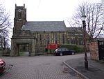
Burnage
Areas of Manchester

Burnage is a suburb of the city of Manchester in North West England, about 4 miles (6.4 km) south of Manchester city centre and bisected by the dual carriageway of Kingsway. Within the boundaries of the historic county of Lancashire, the population of the Burnage Ward at the 2011 census was 15,227. It lies between Withington to the west, Levenshulme to the north, Heaton Chapel to the east and Didsbury and Heaton Mersey to the south.
Excerpt from the Wikipedia article Burnage (License: CC BY-SA 3.0, Authors, Images).Burnage
Kingsway, Manchester Burnage
Geographical coordinates (GPS) Address Nearby Places Show on map
Geographical coordinates (GPS)
| Latitude | Longitude |
|---|---|
| N 53.4258 ° | E -2.2108 ° |
Address
Kingsway
Kingsway
M19 1WQ Manchester, Burnage
England, United Kingdom
Open on Google Maps


