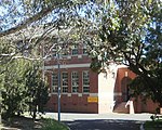
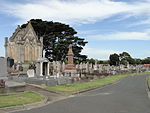
Brighton East, Victoria

Brighton East is a suburb in Melbourne, Victoria, Australia, 12 km south-east of Melbourne's Central Business District, located within the Cities of Bayside and Glen Eira local government areas. Brighton East recorded a population of 16,757 at the 2021 census.Brighton East lies further inland from the coast of Port Philip Bay than Brighton, its affluent, neighbouring community to the west. Its boundaries are Nepean Highway in the northwest, North Road in the north, Thomas Street in the east, Nepean Highway in the southeast, South Road in the south, and Hampton Street in the west. Whilst most of Brighton East is located within the City of Bayside, a number of properties on Thomas Street are located within the City of Glen Eira. Brighton East is known for its spacious parklands, most notably Dendy Park, one of Victoria's 10 biggest parks and outdoor recreation areas, Hurlingham Park, and Landcox Park.
Excerpt from the Wikipedia article Brighton East, Victoria (License: CC BY-SA 3.0, Authors, Images).Brighton East, Victoria
Centre Road, Melbourne Brighton East
Geographical coordinates (GPS) Address Nearby Places Show on map
Geographical coordinates (GPS)
| Latitude | Longitude |
|---|---|
| N -37.916 ° | E 145.015 ° |
Address
Centre Road
Centre Road
3817 Melbourne, Brighton East
Victoria, Australia
Open on Google Maps


