place

Østerås station

1972 establishments in NorwayOslo Metro stations in BærumOslo Metro stubsRailway stations in Norway opened in the 1970sRailway stations opened in 1972
Østerås station
Østerås station

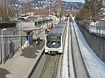
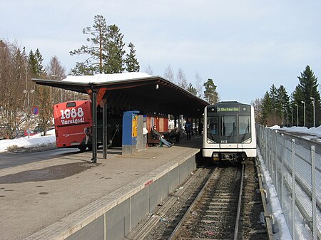
Østerås is the terminal station on the Røa Line of the Oslo Metro. The station is located in Bærum municipality, 10.2 km from Stortinget and was opened on 16 November 1972, extending the line from Lijordet. Østerås is a largely residential area. Next to the station is the middle school Østerås. The station also serves Eikeli Upper Secondary School.

Excerpt from the Wikipedia article Østerås station (License: CC BY-SA 3.0, Authors, Images).

Østerås station
General Fleischers vei, Bærum

Geographical coordinates (GPS) Address Nearby Places
placeShow on map

Wikipedia: Østerås stationContinue reading on Wikipedia

Geographical coordinates (GPS)

Latitude Longitude
N 59.939166666667 ° E 10.608888888889 °
placeShow on map

Address

General Fleischers vei 31
1359 Bærum, Eiksmarka
Norway
mapOpen on Google Maps

Østerås station
Østerås station
Share experience

Nearby Places

Eiksmarka
Eiksmarka

Eiksmarka ("Oakfield") is an affluent suburb of the Norwegian municipality of Bærum in the Greater Oslo Region with around 4,000 inhabitants. It is located just west of the border of Oslo municipality, but within the contiguous urban area of Oslo as well as within the Diocese of Oslo. It is served by Eiksmarka station of the Oslo Metro as well as bus lines. The area consists almost exclusively of private villas, with the exception of the central area near Eiksmarka station, known as Eiksmarka Centre. The latter includes an underground supermarket and a number of specialty shops, including a bakery, a delicatessen, a sushi bar, a flower shop, a pharmacy, clothing stores, a bookstore and a hairdresser, as well as certain public and private offices and a number of upmarket residential apartments. An elementary school, Eiksmarka skole, a kindergarten, a public library and a tennis court are located adjacent to Eiksmarka Centre. Eiksmarka borders the borough of Jar to the south, and belongs to the eastern part of Bærum, commonly regarded as the priciest and most fashionable residential area of Norway. A narrow green belt (approx. 100–200 meters) with the Lysaker River separates Eiksmarka from the Oslo West End borough of Røa on the eastern side of the river. Eiksmarka's northwestern border is also the border of the urban area; the area to the north of Eiksmarka and Røa consists of golf courses, fields and forests. Eiksmarka is known for good golfing, tennis and horse riding, and for its many green areas. The population are among the most affluent and most highly educated in the country. From 2008 to 2011, Eiksmarka had the only Norwegian restaurant outside Oslo with one star in the Michelin Guide. The only gallop racecourse in Norway, Øvrevoll Galloppbane, is located between Eiksmarka and Jar. The name Eiksmarka is translated as Oakfield; the local school, Eiksmarka skole, for example has translated its name as Oakfield Elementary and published the Oakfield Times in connection with English teaching.As of 2014, properties are typically sold for between 1 and 3 million USD, with some villas being sold for as much as 5 million USD.The travel time between Eiksmarka and Nationaltheatret in the central city district of Oslo is 16 minutes with the Oslo Metro line.
Voll, Akershus

Voll is a district in eastern Bærum, Norway. The district Voll was built around the farm of the same name. The farm was mentioned as Vælli in 1398, Woldt in 1578, Wold in 1723 and later Vold. It belonged to the St. Hallvard's Cathedral (now in ruins) during the Middle Ages, and later the state church. In the middle of the seventeenth century the farm came on the hands of bailiff Paul Iversen Vold (1595–1682), who owned several farms in Bærum. In 1721 the farm was separated into two; Nedre and Øvre (Lower and Upper) Wold. The latter farm developed into a district of its own, Øvrevoll. In 1835 the former croft Rugland was separated from Nedre Vold. Today, Øvrevoll and Voll are sometimes referred to as one district. Voll borders Øvrevoll in the north and west, Jar in the south and west and the river Lysakerelva in the east. In 1826 the farm was registered as having 105 decares of crop, two horses, six cattle and nine sheep. This was considerably less than Øvre Vold. The farm also has a history of limestone burning; it contributed limestone to the erection of Akershus Fortress in 1602. However, the limestone was not collected at the farm land, but at Fornebo. Agricultural production on the farm continued well into the twentieth century, especially after horticulturalist Edv. Ellingsen bought the farm in 1921. It was later built up with housing.The farm's communications had been drastically improved in 1872, when the road Vollsveien from Lysaker opened. The main purpose was to aid the timber industry around the river Lysakerelva. Vollsveien was connected to Norwegian National Road 168 around 1930. The area is served by line 131 of Ruter's bus network. Institutions located at Voll include the Finnish Evangelical-Lutheran Congregation in Norway, Finnish: Norjan suomalainen evankelis-luterilainen seurakunta. The local sports team is Øvrevoll Hosle IL.