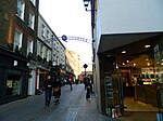
Kingly Street
Soho, LondonStreets in Soho

Kingly Street is a street in London's Soho district. It runs north to south from Liberty's and Foubert's Place to Beak Street, in parallel to, and between, Regent Street and Carnaby Street. It was known as King Street until 1906.The Bag O'Nails at no 9, was a live music club and meeting place for musicians in the 1960s, where Paul McCartney met his future wife Linda Eastman in May 1967. The Northern end runs under the three storey archway that is part of the building that houses the Liberty department store. The renowned Liberty Clock forms part of the masonry section of the archway and looks out over the Northern entrance of Kingly Street.
Excerpt from the Wikipedia article Kingly Street (License: CC BY-SA 3.0, Authors, Images).Kingly Street
Regent Street, London Mayfair
Geographical coordinates (GPS) Address Nearby Places Show on map
Geographical coordinates (GPS)
| Latitude | Longitude |
|---|---|
| N 51.5129 ° | E -0.1397 ° |
Address
Hamleys
Regent Street 188-196
W1B 5BT London, Mayfair
England, United Kingdom
Open on Google Maps


