place

Bringle Ferry Bridge

Buildings and structures in Davidson County, North CarolinaBuildings and structures in Rowan County, North CarolinaNorth Carolina building and structure stubsNorth Carolina transportation stubsRoad bridges in North Carolina
Southern United States bridge (structure) stubsTransportation in Davidson County, North CarolinaTransportation in Rowan County, North Carolina

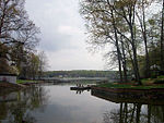
The Bringle Ferry Bridge is a crossing of the Yadkin River Channel and the Tuckertown Reservoir in Rowan County, North Carolina and Davidson County, North Carolina. The bridge is on Bringle Ferry Road between Salisbury, North Carolina and Denton, North Carolina. It is the only crossing of the Yadkin River between the Interstate 85 bridge at Spencer, North Carolina and the NC Hwy 49 bridge near Richfield, North Carolina. The Bringle Ferry Bridge has views of the High Rock Dam to the north, which separates Tuckertown Reservoir from High Rock Lake.

Excerpt from the Wikipedia article Bringle Ferry Bridge (License: CC BY-SA 3.0, Authors).

Bringle Ferry Bridge
Bringle Ferry Road,

Geographical coordinates (GPS) Address External links Nearby Places
placeShow on map

Wikipedia: Bringle Ferry BridgeContinue reading on Wikipedia

Geographical coordinates (GPS)

Latitude Longitude
N 35.596666666667 ° E -80.231666666667 °
placeShow on map

Address

Bringle Ferry Bridge

Bringle Ferry Road

North Carolina, United States
mapOpen on Google Maps

linkWikiData (Q4968384)
linkOpenStreetMap (561333855)

Share experience

Nearby Places

High Rock Lake
High Rock Lake

High Rock Lake is a reservoir located on the Yadkin River in central North Carolina in the counties of Davidson and Rowan. Built in 1926-27 by the Tallassee Power Company, a wholly owned subsidiary of the Aluminum Company of America (Alcoa), the lake is the northernmost of a series of four hydroelectric projects designed at the time to support the company’s Badin Works, a large aluminum smelting operation located 16 miles downstream in the community of Badin. After the permanent closing of the Badin Works in 2007, Alcoa continued to operate its Yadkin hydroelectric facilities until selling them to Cube Hydro Carolinas in 2016. At the time of construction, High Rock was the largest reservoir in North Carolina and one of the largest in the United States. When full, its surface covers 15,180 acres (61 km2) with 360 miles (579 km) of shoreline and is 59 feet (18 m) deep at the dam. Normal pool elevation is 624 feet above sea level (655’ 1926 Alcoa datum). Upstream, the Yadkin River drains 4,341 square miles (10,290 km2) of the land area of North Carolina’s northwest piedmont.The dam was built in a small gorge formed where the river cuts through a major ridge of the Uwharrie Mountains. High Rock Mountain, the highest point in the Uwharries, towers over the adjoining dam site creating one of the most extensive views found in the North Carolina piedmont. Both the mountain and the lake are named for the “high rocks”, a large outcropping of rocks located on the ridge approximately half a mile east of the dam. Being its furthest upstream resource, High Rock was managed by Alcoa during most of its years of ownership not only for its electricity production, but also to control water levels in all the Uwharrie Lakes downstream. This often resulted in extreme drawdown during summer months when normal river flow was low. The impoundment extends some nineteen miles upstream from the dam to the mouth of South Yadkin River near Salisbury. Major arms of the lake are formed by numerous creeks including Flat Swamp, Abbotts, Buddle, Swearing, and North and South Potts in Davidson County; and Panther, Dutch Second, and Crane in Rowan County. The main trunk’s widest point exceeds one mile. Since its construction, surrounding communities including Lexington, Salisbury, Southmont, Spencer, and Denton, have enjoyed tremendous economic benefit through recreation driven by the lake. High Rock has proven to be one of the outstanding sites in the southeast for inland sailing, power boating, and fishing. In recent years, paddling has been added to the list with the designation of the Yadkin River State Canoe Trail which traverses the length of the lake, along with the trail's Daniel Boone Heritage section which terminates at the lake's York Hill Access.

Tuckertown Reservoir

The Tuckertown Reservoir is the reservoir formed by the Tuckertown Dam 35°29′05″N 80°10′36″W at the North end of Badin Lake and the High Rock Dam 35°36′03″N 80°14′06″W at the bottom of High Rock Lake in the Uwharrie Lakes Region in the U.S. state of North Carolina. The reservoir is located in Davidson County, Stanly County, Montgomery County, and Rowan County and contains the wide and navigable waterway of the Yadkin River. The dam itself, at the south end of the reservoir, spans the river between Harris Township in Stanly County and Eldorado Township in Montgomery County. Used for hydroelectric power generation, Tuckertown Lake was historically managed and operated by the Alcoa company, but in February 2017 Alcoa sold the power generation to Cube Hydro Carolinas LLC, an affiliate of Cube Hydro Partners, LLC.The lake has multiple crossings. One is the Bringle Ferry Bridge that bridges the river between High Rock (in Davidson County) and Pooletown (in Rowan County), and from which there are views of the High Rock Dam. The second crossing is the NC Hwy 49 Bridge at Tuckertown. The next bridge north of the Bringle Ferry Bridge is located at the Interstate 85 crossing near Salisbury. There are more crossings in the backs of the lakes creeks. The next bridge south of the NC Hwy 49 Bridge is at the James B. Garrison Bridge over Lake Tillery between Albemarle and Troy. The Tuckertown Reservoir occupies a narrow valley in the western edge of the ancient Uwharrie Mountains.