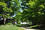
Petersham (CDP), Massachusetts
Census-designated places in MassachusettsCensus-designated places in Worcester County, MassachusettsUse mdy dates from July 2023Worcester County, Massachusetts geography stubs

Petersham is a census-designated place (CDP) comprising the main village in the town of Petersham, Worcester County, Massachusetts, United States. Massachusetts Route 32 passes through the village, leading north 9 miles (14 km) to Athol and southeast 7 miles (11 km) to Barre. Massachusetts Route 122 joins Route 32 in the village center, leading southeast with it to Barre but northwest 11 miles (18 km) to Orange. As of the 2010 census, the population of the CDP was 243, out of 1,234 in the entire town of Petersham.
Excerpt from the Wikipedia article Petersham (CDP), Massachusetts (License: CC BY-SA 3.0, Authors, Images).Petersham (CDP), Massachusetts
West Street,
Geographical coordinates (GPS) Address Nearby Places Show on map
Geographical coordinates (GPS)
| Latitude | Longitude |
|---|---|
| N 42.488333333333 ° | E -72.186944444444 ° |
Address
West Street 5
01366
Massachusetts, United States
Open on Google Maps


