place

Thurstonland

AC with 0 elementsHolme ValleyKirkburtonPeak DistrictTowns and villages of the Peak District
Villages in West Yorkshire
Thurstonland, West Yorkshire, UK (RLH)02

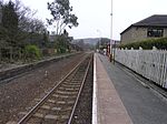
Thurstonland is a rural village in the civil parish of Kirkburton in Kirklees, West Yorkshire, England. It has a population of almost 400. Thurstonland Urban District was created in 1894 and merged with Farnley Tyas urban district in 1925. Both were abolished in 1938 under a County Review Order, and most of the district was merged into Kirkburton Urban District and the remainder into the Holmfirth Urban District. It is just outside the borders of the Peak District National Park. The village is situated on a hilltop above Brockholes and to the southeast of Farnley Tyas and north of Shepley in the Huddersfield (HD4) postal district. The village has a public house, First school - (Thurstonland Endowed First School), church, a children's recreational area and a cricket club. Apart from the pub on the southern edge of the village the other facilities are all located next to each other, at the northern edge. Through the hill is the Thurstonland Tunnel on the Penistone railway line, between Brockholes railway station and Stocksmoor railway station. Within and around the village are a number of small dairy farms, that supply the surrounding area.

Excerpt from the Wikipedia article Thurstonland (License: CC BY-SA 3.0, Authors, Images).

Thurstonland
The Village, Kirklees

Geographical coordinates (GPS) Address Nearby Places
placeShow on map

Wikipedia: ThurstonlandContinue reading on Wikipedia

Geographical coordinates (GPS)

Latitude Longitude
N 53.59 ° E -1.75 °
placeShow on map

Address

The Village

The Village
HD4 6XX Kirklees
England, United Kingdom
mapOpen on Google Maps

Thurstonland, West Yorkshire, UK (RLH)02
Share experience

Nearby Places

New Mill, West Yorkshire

New Mill, West Yorkshire, England, is a small, semi-rural village near the town of Holmfirth. It is in the metropolitan borough of Kirklees and the civil parish of Holme Valley. The village had a population of 1,259 (with Fulstone) in the 2001 census. The village is 2 miles (3.2 km) east of Holmfirth and 6 miles (9.7 km) south of Huddersfield. The centre of the village is now on the crossroads of the Huddersfield - Sheffield A616 and Barnsley - Manchester A635 roads. There is a Post Office, one pub, one Indian restaurant, a branch of the local Co-op and 2 pharmacies plus other amenities all centred on the crossroads. The village centre used to be sited slightly further east near the church on Sude Hill. Unsurprisingly, there were textile mills in the village such as Moorhouse & Brookes, on Greenhill Bank Road, and Bower and Roebuck, nestling in the valley just off the A616 Sheffield Road. With the decline in traditional heavy woollen industries both these mills have now closed. Bower & Roebuck's Wildspur Mills provided an opportunity for property developers to convert it into flats, Moorhouse & Brookes' mill has been demolished and a new housing development built on the site.The village is also home to the New Mill Male Voice Choir, which was established in 1991.New Mill was created an urban district of the West Riding of Yorkshire in 1895, and covered the parishes of Fulstone, Hepworth and Scholes. The urban district was abolished in 1938 by a County Review Order which saw the district and parishes merged into the urban district and parish of Holmfirth, which has been since included in Kirklees, West Yorkshire and renamed Holme Valley.

A635 road
A635 road

The A635 is a main road that runs between Manchester and Scawsby running east–west through Stalybridge, Saddleworth Moor, Holmfirth, Barnsley and Doncaster. The section forming the eastern part of the Mancunian Way is a motorway and is officially designated as the A635(M) though there is no road sign with this designation, and the signs at the entrance of Mancunian Way westbound show A57(M). The section between Greenfield and Holmfirth, which passes across Saddleworth Moor, is known locally as the Isle of Skye Road after a public house that was at Wessenden Head until it was demolished in the 1950s after a fire. It passes over treeless high moor top for about 4 miles: Saddleworth Moor west of the county boundary and Wessenden Head Moor to the east. This section of the road is at high altitude and in winter months local snowfall usually results in closures of the road. In January 2010, as a result of the extreme winter, the road was closed for over a month, and other closures also occurred in the same winter. Unlike the other Pennine passes in the area such as the A57 Snake Pass (Manchester to Sheffield), the A62 (Manchester to Huddersfield and Leeds) and the A58 (Rochdale to Halifax and Leeds), the section of the A635 over the Pennines enjoys much quieter traffic since the A628 Woodhead pass is much more direct when travelling between Manchester and Barnsley, connecting directly to the M1 junction 37 and passing through the centre of Barnsley. In 2012, after a recent increase of car incident rates over the moors, a 50mph speed limit was put in place between Greenfield and Holmfirth. In Barugh Green there's a small junction where the B6428 terminates. The road continues through Barnsley to Doncaster where it merges with the A638. The road became infamous because of its connection with the 1960s Moors murders. The grave sites of victims are located, adjacent to the road between Greenfield and Holmfirth, close to an area called Hollin Brown Knoll, which overlooks the 3 reservoirs: Dovestone, Yeoman and Greenfield. A section of the road at the Manchester end had to be closed in August 2015 after it collapsed following unusually torrential rain.

Stocksmoor
Stocksmoor

Stocksmoor is a hamlet, near Huddersfield, West Yorkshire, England. It is situated between the villages of Shepley and Brockholes. The total population of Thurstonland, Stocksmoor and Thunder Bridge together was 953 in the 2001 census.[1] It has a railway station on the Penistone railway line which connects Huddersfield and Sheffield and is the traditional terminus of the 341 (First Huddersfield) bus service from Huddersfield town centre. Stocksmoor is the birthplace of Ben Swift Chambers, the church minister who, in Liverpool, founded St Domingo's parish football team, which became Everton Football Club. In 1838, upwards of 1,000 small Roman coins of copper and brass were found at Whistones, Stocks Moor. The Times of London describes how they were found by a labouring man who was digging in a field not far from Thurstonland and found them near the foundation of a wall. Yet, 'as is often the case in such discoveries, being a stranger to their value, he was induced to part with them to different individuals for a trifling consideration.' It then goes on to describe how they 'understand that among the coins discovered at Thurstonland there are many of the lower empire, several of Carausius, who, it will be remembered, possessed himself of Britain, as emperor, under Dioclesian, and who repaired the Roman wall in Scotland. In the collection purchased by one individual there are the coins of Constantine, Constantius, Lucilius, and others.'