Brockholes
AC with 0 elementsGeography of HolmfirthHolme ValleyTowns and villages of the Peak DistrictUse British English from March 2015 ... and 2 more
Vague or ambiguous time from March 2015Villages in West Yorkshire

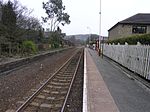
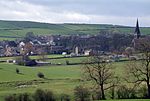
Brockholes is a small village in West Yorkshire, England, in the administrative area of Kirklees Metropolitan Council and Holme Valley Parish Council. The village of Honley borders to the immediate north of the village and Holmfirth lies to the south. Brockholes is within the Postal district of Holmfirth.
Excerpt from the Wikipedia article Brockholes (License: CC BY-SA 3.0, Authors, Images).Brockholes
Ridings Fields, Kirklees Holme Valley
Geographical coordinates (GPS) Address Nearby Places Show on map
Geographical coordinates (GPS)
| Latitude | Longitude |
|---|---|
| N 53.597 ° | E -1.7698 ° |
Address
Brockholes
Ridings Fields
HD9 7BG Kirklees, Holme Valley
England, United Kingdom
Open on Google Maps


