Thurstonland and Farnley Tyas Urban District
AC with 0 elementsLocal government in KirkleesUrban districts of EnglandUse British English from July 2020West Yorkshire geography stubs
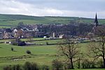
Thurstonland and Farnley Tyas was an urban district in the West Riding of Yorkshire from 1925 to 1938. It was created in 1925 by the merger of the Thurstonland and Farnley Tyas urban districts (both created in 1894). In 1938 it was itself abolished, under a County Review Order, with most going to Kirkburton urban district, and part to Holmfith Urban District. The area now forms part of the Kirklees metropolitan borough in West Yorkshire.
Excerpt from the Wikipedia article Thurstonland and Farnley Tyas Urban District (License: CC BY-SA 3.0, Authors).Thurstonland and Farnley Tyas Urban District
Marsh Hall Lane, Kirklees
Geographical coordinates (GPS) Address Nearby Places Show on map
Geographical coordinates (GPS)
| Latitude | Longitude |
|---|---|
| N 53.597 ° | E -1.749 ° |
Address
Marsh Hall Lane
Marsh Hall Lane
HD4 6XD Kirklees
England, United Kingdom
Open on Google Maps


