Ruislip Lido

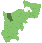
Ruislip Lido ( RY-slip LY-doh) is a reservoir and artificial beach in Ruislip, within the London Borough of Hillingdon, England, situated between Ruislip Common, Ruislip Woods (a Site of Special Scientific Interest), and Poor's Field. Originally created as a feeder basin for the Grand Junction Canal in 1811, the reservoir was reopened in 1933 as a lido, with facilities for swimming and boating. During the Second World War, the lido was secretly used by the Royal Air Force to train aircrew based at RAF Northolt and RAF Uxbridge in water survival methods. A narrow gauge railway, the Ruislip Lido Railway was opened in 1945, and now runs about two thirds of the distance around the reservoir.Having fallen into a state of disrepair during the 1970s and 1980s, the lido has since undergone renewal works, and was the subject of an enhancement project unveiled by the London Borough of Hillingdon in January 2010. The project involved the return of boating and swimming in the reservoir, which had previously not been possible due to pollution and an artificially low water level.
Excerpt from the Wikipedia article Ruislip Lido (License: CC BY-SA 3.0, Authors, Images).Ruislip Lido
Reservoir Road, London
Geographical coordinates (GPS) Address Nearby Places Show on map
Geographical coordinates (GPS)
| Latitude | Longitude |
|---|---|
| N 51.59028 ° | E -0.4323 ° |
Address
Waters Edge
Reservoir Road
HA4 7TY London
England, United Kingdom
Open on Google Maps


