Edgewood Historic District–Aberdeen Plat
Cranston, Rhode IslandHistoric districts in Providence County, Rhode IslandHistoric districts on the National Register of Historic Places in Rhode IslandNRHP infobox with nocatNational Register of Historic Places in Providence County, Rhode Island

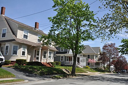
The Edgewood Historic District–Aberdeen Plat is a residential historic district in the Edgewood neighborhood of eastern Cranston, Rhode Island. Bounded by Berwick Lane and Sefton Drive to the north, Broad Street to the west, Chiswick Road to the south, and the Providence River to the east, this area was developed between 1901 and 1957 as a streetcar suburb for middle and upper middle class residents on what was once a country estate. The district was listed on the National Register of Historic Places in 2016.
Excerpt from the Wikipedia article Edgewood Historic District–Aberdeen Plat (License: CC BY-SA 3.0, Authors, Images).Edgewood Historic District–Aberdeen Plat
Strathmore Road, Cranston
Geographical coordinates (GPS) Address Nearby Places Show on map
Geographical coordinates (GPS)
| Latitude | Longitude |
|---|---|
| N 41.770379 ° | E -71.392584 ° |
Address
Strathmore Road 68
02905 Cranston
Rhode Island, United States
Open on Google Maps


