place

Lower Caversham

Berkshire geography stubsSuburbs of Reading, BerkshireUse British English from May 2017
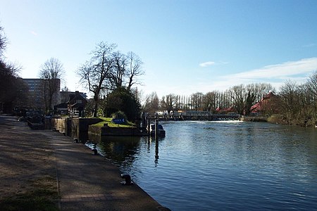
Caversham lock and weir

Lower Caversham is an area of the former town of Caversham, in the English county of Berkshire (formerly Oxfordshire). Today this is itself a suburb of the larger town of Reading. Lower Caversham has no formal boundaries, but the name usually refers to that part of Caversham situated on lower ground to the east of central Caversham, close to the River Thames.The area lies entirely within the Caversham ward of the borough of Reading. As a unitary authority, the borough is responsible for all aspects of local government within the area. Lower Caversham is within the Reading East parliamentary constituency.Caversham Lock is situated on the south bank of the Thames, and is connected to Lower Caversham by a weir—popularly known as The Clappers— which carries a public footpath across the river. This path also provides access to View Island, now a public park. Upstream of the lock, Reading Bridge provides a direct road link between Reading town centre and Lower Caversham.

Excerpt from the Wikipedia article Lower Caversham (License: CC BY-SA 3.0, Authors, Images).

Geographical coordinates (GPS)

Latitude Longitude
N 51.464916 ° E -0.959587 °
placeShow on map
Caversham lock and weir
Share experience

Nearby Places

Reading Hydro
Reading Hydro

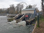
Reading Hydro is a micro hydroelectric scheme in Reading, England. It is located on the River Thames, at the upstream end of View Island and using the head of water provided by the weir at Caversham Lock. With a drop of about 1.4 metres (4 ft 7 in) and an average water flow of 37 cubic metres (1,300 cu ft) per second, it can generate 46 kilowatts (62 hp) of electricity with its twin archimedes screw turbines.The scheme is owned and operated by the Reading Hydro CBS, a community benefit society that was founded in 2017, after some years of preparation. By 2018, planning permission had been granted and construction plans developed. Investment was raised through share offers to the local community, and the scheme was officially opened on 13 August 2021.The turbine house has been decorated on two sides with a mural by Commando Jugendstil, entitled Community Energym, and representing the Reading Hydro community and the sustainable power the project will generate. A third side contains a rendition of Warming Stripes, a visual representations of the change in global temperature over the past 100+ years originally created by Professor Ed Hawkins of Reading University.Although the weir already had a fish pass, this was found to be too steep for many species of fish. As part of the approvals process for the hydro scheme, a new fish pass has been constructed on View Island in the form of a stream that crosses the island on a more natural sinuous course. Both the turbine house and the fish pass are readily accessible by the public footpath, locally known as The Clappers, that crosses over both the lock and weir, and gives access to View Island.

Christchurch Meadows, Reading

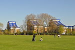
Christchurch Meadows is a park in Reading, Berkshire, England, located next to the River Thames. It stretches along the north (Caversham) side of the river, between Caversham Bridge and Reading Bridge, and is linked to the south (Reading) bank by the Christchurch Bridge, a pedestrian and cycle bridge built in 2015. The name of the meadow derives from Christ Church in Oxford, whose dean owned 25 acres (10 ha) of farmland in Reading.Christchurch Meadows form part of a series of riverside open spaces, managed by Reading Borough Council, that stretch along one or other side of the River Thames throughout its passage through Reading. From west to east these are Thameside Promenade, Caversham Court, Christchurch Meadows, Hills Meadow, View Island and King's Meadow.The park takes the form of a grass meadow along the river's edge, with specimen trees and shrubs along the bank. At the eastern end there is a fenced children’s play area, with a paddling/boating pool and picnic tables, and a number of sports pitches. A distinctive line of Lombardy poplars edges the eastern boundary. At the western end, the Caversham War Memorial and the Reading University Boat Club can be found.A metalled footpath and cycleway runs along the river bank and provides an alternative to the formal route of the Thames Path long distance footpath, which runs along the built-up southern bank of the river between Reading and Caversham bridges. A second metalled footpath and cycleway connects the northern end of Christchurch Bridge with Gosbrook Road in Caversham, and intersects with the riverside path.