place

Bass Lake (Marin County, California)

Lakes of CaliforniaLakes of Marin County, CaliforniaWetlands of the San Francisco Bay Area

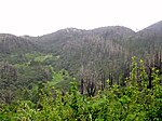
Bass Lake is a small lake in the southern portion of the Point Reyes National Seashore, northwest of Bolinas. The lake sits at an elevation of 374 feet (114 m) and flows out south to the ocean via a 1-mile (1.6 km) creek. Bass Lake is the largest of the five Coast Trail Lakes, which also include Pelican Lake, Crystal Lake, Ocean Lake and Wildcat Lake.

Excerpt from the Wikipedia article Bass Lake (Marin County, California) (License: CC BY-SA 3.0, Authors).

Bass Lake (Marin County, California)
Coast Trail,

Geographical coordinates (GPS) Address Nearby Places
placeShow on map

Wikipedia: Bass Lake (Marin County, California)Continue reading on Wikipedia

Geographical coordinates (GPS)

Latitude Longitude
N 37.950277777778 ° E -122.77527777778 °
placeShow on map

Address

Coast Trail

Coast Trail

California, United States
mapOpen on Google Maps

Share experience

Nearby Places

Alamere Falls
Alamere Falls

Alamere Falls is a waterfall in Point Reyes National Seashore, Marin County, California. Alamere Falls is a rare "tidefall", a waterfall that flows directly into the ocean. It is one of only two known tidefalls in California, the other being McWay Falls.Alamere Falls tumble over fragile shale cliffs at Alamere Creek Beach. Upstream of the main Alamere Falls is the upper Alamere Falls, consisting of three separate cascades. Together, these cascades are approximately 20–30 feet (6–9 m) in height. All of these waterfalls are fed by the Alamere Creek.Alamere Falls can be reached by following the Coast Trail from the Palomarin Trailhead at the end of Mesa Road out of Bolinas, California. After 2.5 mi (4.0 km), the trail passes two small lakes (Bass Lake and Pelican Lake). Bass Lake can be accessed by a side trail that leads to a rope swing, and hikers often stop for a swim during summer months. From the Palomarin Trailhead, the hike is 3.8 mi (6.1 km), one-way, to the top of the falls. To reach the bottom of the falls, the National Park Service advises hikers to continue to Wildcat Campground, descend to the beach and then walk 1.1 mi (1.8 km) south; the one-way distance from Palomarin Trailhead to the base of the falls is 6.6 mi (10.6 km). This trail leads along the beach, check out the tides before to figure out the exact time for low tide. Usually, the beach to Alamere Falls is unsafe to access at high tide, and hikers are frequently trapped.