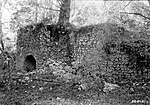
Samuel Penfield Taylor (October 9, 1827, in Saugerties, New York – January 22, 1886, in San Francisco, California) was an entrepreneur who made his fortune during the California Gold Rush. He is best known for building the Pioneer Paper Mill, the first paper mill in California. Taylor sailed from Boston Harbor in a schooner that he purchased with a group of friends, arriving in San Francisco ten months later.Taylor's first business in California was a bacon and egg stand on the beach. "Upon arrival Taylor found a wooden cask of eggs floating near the shore. He cooked the eggs, overturned the cask, and set up a food stand on the beach." In 1853, Taylor left for Hawkins Bar, California, in Tuolumne County to prospect for gold. He used his profits to buy land in Marin County and enter the paper business.Samuel Taylor was ahead of his time in producing recycled paper products from rags and old papers that his employees collected from various California cities and in creating the first fish ladder on the West Coast to help fish swim upstream around the dam near his paper mill. Taylor married Sarah Washington Irving, raised a family of seven boys and one girl, and served on the San Francisco Board of Supervisors. Working with other concerned citizens, Mr. and Mrs. Taylor helped stop the importation of Chinese slave girls into San Francisco.
After Samuel Taylor's death in 1886, his wife lost the paper mill and land around it in the Panic of 1893. The new owners of the Taylors' land (who refused to allow Sarah Taylor to be buried next to her husband on the family plot) lost the property themselves when it was taken by the State of California in 1945 for non-payment of taxes. The state then created Samuel P. Taylor State Park.
Taylor is buried on a hill overlooking the former site of the mill. His gravesite was restored in 1997 by Freemasons of San Francisco Oriental Lodge No. 144. Sarah Washington Irving now lies next to her husband on the southwest slope of Barnabe Mountain (near 38.0263°N 122.732°W / 38.0263; -122.732).


