place

Aloha Camp

1905 establishments in VermontBuildings and structures completed in 1905Buildings and structures in Fairlee, VermontHistoric districts on the National Register of Historic Places in VermontNRHP infobox with nocat
National Register of Historic Places in Orange County, VermontQueen Anne architecture in VermontSummer camps in VermontTemporary populated places on the National Register of Historic PlacesUse mdy dates from August 2023
FairleeVT AlohaCamp
FairleeVT AlohaCamp

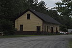
Aloha Camp is a summer camp for girls on Lake Morey in Fairlee, Vermont. Founded in 1905, it is the oldest girls' camp in the state. Open to children aged 12 to 17, it offers outdoor activities, arts and nature programs, and wilderness camping opportunities. The camp season is divided into two sessions of 3-1/2 weeks, running from late June to mid-August. The camp property is listed on the National Register of Historic Places.

Excerpt from the Wikipedia article Aloha Camp (License: CC BY-SA 3.0, Authors, Images).

Aloha Camp
Lake Morey Road,

Geographical coordinates (GPS) Address Nearby Places
placeShow on map

Wikipedia: Aloha CampContinue reading on Wikipedia

Geographical coordinates (GPS)

Latitude Longitude
N 43.928055555556 ° E -72.155 °
placeShow on map

Address

Lake Morey Road 2068
05045
Vermont, United States
mapOpen on Google Maps

FairleeVT AlohaCamp
FairleeVT AlohaCamp
Share experience

Nearby Places

Orford Street Historic District

The Orford Street Historic District encompasses a particularly attractive stretch of Orford Street (New Hampshire Route 10) in Orford, New Hampshire. It was described as early as the 18th century as "the most charming country village", with a tree-lined promenade that is still a focus of the town center. The district consists of about 0.5 miles (0.80 km) of Orford Street, between its junctions with New Hampshire Route 25A and Archertown Road, and was listed on the National Register of Historic Places in 1977.The west side of Orford Street lies between the street and the Connecticut River, and is lined with a series of 18th and 19th century residential and civic buildings. Prominent among them are a series of Federal-style houses, built between 1773 and 1839, along what is called The Ridge. These houses exhibit the influence of architect Asher Benjamin, who is believed to have designed one of them. Other properties in the district include the brick Masonic hall (1840, formerly a Universalist church), the Gothic Revival Orford Congregational Church (1850), and the 1851 academy. Near the southern end of the district stands its only surviving commercial building, at the southwest corner of Bridge Street. The east side of Orford Street is dominated by a large common with tree-lined promenade. The promenade consists of a now-paved lane flanked on either side by mature trees, and was first laid out about 1800. At the northernmost end of the district, just east of the promenade, is the town cemetery, established in 1773 on land donated by Israel Morey.

Piermont Bridge
Piermont Bridge

The Piermont Bridge carries New Hampshire Route 25 over the Connecticut River to the contiguous Vermont Route 25 between Piermont, New Hampshire and Bradford, Vermont. It is a Pennsylvania steel through truss bridge, built by the Boston Bridge Works in 1928. The bridge consists of a single span with a clear span of 352' and an overall length of 354'10". The roadbed is 20'7" wide, with a vertical clearance of 14'7". The bridge is approximately 25' above the river. The western (Vermont) abutment is made of split granite quarried from nearby Fairlee Mountain, while the eastern abutment is an early concrete construction built in 1908 by John Storrs for an earlier bridge. The bridge underwent a major renovation in 1993 which included the addition of a sidewalk (under which utilities were laid) and replacement of much of the bridge decking.The bridge was built in the aftermath of major rain and flooding in 1927 along the Connecticut River, which washed away several bridges and caused significant damage in Vermont. The Piermont Bridge was the longest bridge built after this flooding, replacing a c. 1875 two-span Town lattice truss bridge. The center pier of the older bridge was knocked down to the water line and is still visible. The eastern abutment, built in 1908 in a relatively early use of structural concrete, needed to be strengthened to accommodate the increased weight of the new steel bridge. This was accomplished by adding new concrete to the land side of the abutment, preserving the earlier work.The bridge was listed on the National Register of Historic Places in 2001. It is owned by the states of New Hampshire (90%) and Vermont (10%).