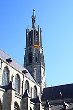
Kapellebrug
HulstPopulated places in ZeelandZeeland geography stubs

Kapellebrug is a village in the Dutch province of Zeeland. It is a part of the municipality of Hulst, and lies about 31 km southwest of Bergen op Zoom. The village was first mentioned in 1459 as ter Eecken, and is a combination of chapel and bridge.Kapellebrug was home to 278 people in 1840. The village used to be split in the municipalities Sint Jansteen and Clinge. In 1970, it became part of the municipality of Hulst.
Excerpt from the Wikipedia article Kapellebrug (License: CC BY-SA 3.0, Authors, Images).Kapellebrug
Sint Janstraat, Hulst
Geographical coordinates (GPS) Address Nearby Places Show on map
Geographical coordinates (GPS)
| Latitude | Longitude |
|---|---|
| N 51.254166666667 ° | E 4.0647222222222 ° |
Address
Sint Janstraat 3
4565 EN Hulst
Zeeland, Netherlands
Open on Google Maps


