place

Port Perry

Communities in the Regional Municipality of DurhamFormer municipalities in OntarioPopulated places disestablished in 1974Use Canadian English from January 2023
PortPerryPost
PortPerryPost

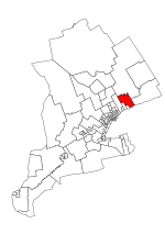
Port Perry is a community located in Scugog, Ontario, Canada. The town is located 84 kilometres (52 mi) northeast of central Toronto, north of Oshawa, and east of Whitby. Port Perry has a population of 9,553 as of 2021. Port Perry serves as the administrative and commercial centre for the township of Scugog. The town is home to a 24-bed hospital (Lakeridge Health Port Perry), Scugog Township's municipal offices and many retail establishments. Port Perry serves as a hub for many small communities in the Scugog area, such as Greenbank, Raglan, Caesarea, Blackstock and Nestleton/Nestleton Station. The Great Blue Heron Charitable Casino is a major employer. Located at the basin of the Trent-Severn Waterways is Lake Scugog, one of Ontario's largest man-made lakes.

Excerpt from the Wikipedia article Port Perry (License: CC BY-SA 3.0, Authors, Images).

Port Perry
Elsavatalstraße,

Geographical coordinates (GPS) Address Nearby Places
placeShow on map

Wikipedia: Port PerryContinue reading on Wikipedia

Geographical coordinates (GPS)

Latitude Longitude
N 44.104722222222 ° E -78.944166666667 °
placeShow on map

Address

Elsavatalstraße
63820 , Rück
Bayern, Deutschland
mapOpen on Google Maps

PortPerryPost
PortPerryPost
Share experience

Nearby Places

Durham (federal electoral district)

Durham (formerly known as Clarington—Scugog—Uxbridge) is a federal electoral district in Ontario, Canada, that has been represented in the House of Commons of Canada from 1904 to 1968 and since 1988. Its first iteration was created in 1903 from Durham East and Durham West ridings. It consisted of the county of Durham. The electoral district was abolished in 1966 when it was merged into the Northumberland—Durham riding. It was recreated in 1987 from parts of the Durham—Northumberland and Ontario ridings. The second incarnation of the riding initially consisted of the Town of Newcastle, the townships of Scugog and Uxbridge, Scugog Indian Reserve No. 34, the part of the City of Oshawa lying north of Rossland Road, the allowance for road in front of lots 1, 2, 3 and 4, Concession 3 and part of the Town of Whitby lying north of Taunton Road. In 1996, it was redefined to consist of the Township of Scugog, Scugog Indian Reserve No. 34, the Town of Clarington and part of the City of Oshawa lying north of a line drawn from west to east along Taunton Road, south along Ritson Road North, east along Rossland Road East, south along Harmony Road North and east along King Street East. The electoral district was abolished in 2003 when it was redistributed between Clarington—Scugog—Uxbridge, Oshawa and Whitby—Oshawa ridings. Clarington—Scugog—Uxbridge was defined to consist of the townships of Uxbridge and Scugog, the Municipality of Clarington and the Mississaugas of Scugog Island reserve. In 2004, Clarington—Scugog—Uxbridge was renamed to its current name of Durham. Following the Canadian federal electoral redistribution of 2012, the riding lost territory to Pickering—Uxbridge and Northumberland—Peterborough South and gained territory from Oshawa and Whitby—Oshawa. On August 24, 2020, then-Durham MP Erin O'Toole won the Conservative Party leadership election and was named Leader of the Official Opposition.