place

Old Castle (Koblenz)

13th-century architectureBuildings and structures in KoblenzCastles in Rhineland-PalatinateCastles on the MoselleLowland castles
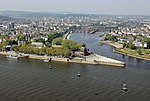
Koblenz im Buga Jahr 2011 Alte Burg 01

The Old Castle (German: Alte Burg) was a former Elector-owned, substantial water castle in the German city of Koblenz, incepted in the 13th century. It is today reduced to the later Burghaus (castle house); which houses the city archives. It sits on tall foundations and has a tall, black slate roof with further floors in the attic and two small cupolas. The lowland castle abutted the remaining building in the old town quarter. The castle house stands tall, next to the Moselle's right-bank towpath downstream of the strategic Baldwin Bridge (lowest crossing of the river) built in 1342. The bridge, much-repaired, remains intact.

Excerpt from the Wikipedia article Old Castle (Koblenz) (License: CC BY-SA 3.0, Authors, Images).

Old Castle (Koblenz)
Peter-Altmeier-Ufer, Koblenz Altstadt

Geographical coordinates (GPS) Address External links Nearby Places
placeShow on map

Wikipedia: Old Castle (Koblenz)Continue reading on Wikipedia

Geographical coordinates (GPS)

Latitude Longitude
N 50.362361 ° E 7.594028 °
placeShow on map

Address

Alte Burg

Peter-Altmeier-Ufer
56068 Koblenz, Altstadt
Rhineland-Palatinate, Germany
mapOpen on Google Maps

linkWikiData (Q435449)
linkOpenStreetMap (155559340)

Koblenz im Buga Jahr 2011 Alte Burg 01
Share experience

Nearby Places

Rhine Province
Rhine Province

The Rhine Province (German: Rheinprovinz), also known as Rhenish Prussia (Rheinpreußen) or synonymous with the Rhineland (Rheinland), was the westernmost province of the Kingdom of Prussia and the Free State of Prussia, within the German Reich, from 1822 to 1946. It was created from the provinces of the Lower Rhine and Jülich-Cleves-Berg. Its capital was Koblenz and in 1939 it had 8 million inhabitants. The Province of Hohenzollern was militarily associated with the Oberpräsident of the Rhine Province. The Rhine Province was bounded on the north by the Netherlands, on the east by the Prussian provinces of Westphalia and Hesse-Nassau, and the grand duchy of Hesse-Darmstadt, on the southeast by the Palatinate (a district of the Kingdom of Bavaria), on the south and southwest by Lorraine, and on the west by Luxembourg, Belgium and the Netherlands. The small exclave district of Wetzlar, wedged between the grand duchy states Hesse-Nassau and Hesse-Darmstadt was also part of the Rhine Province. The principality of Birkenfeld, on the other hand, was an enclave of the Grand Duchy of Oldenburg, a separate state of the German Empire. In 1911, the extent of the province was 10,423 km2 (4,024 sq mi); its extreme length, from north to south, was nearly 200 km (120 mi), and its greatest breadth was just under 90 km (56 mi). It included about 200 km (120 mi) of the course of the Rhine, which formed the eastern border of the province from Bingen to Koblenz, and then flows in a north-northwesterly direction inside the province, approximately following its eastern border. It is now part of North Rhine-Westphalia, Rhineland-Palatinate, Saarland, and Hesse.