place

Smethwick Rolfe Street railway station

1852 establishments in EnglandDfT Category E stationsFormer London and North Western Railway stationsRailway stations in Great Britain opened in 1852Railway stations in Sandwell
Railway stations served by West Midlands TrainsSmethwickUse British English from February 2017West Midlands (county) building and structure stubsWest Midlands (region) railway station stubs
Smethwick Rolfe Street Station 2

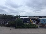
Smethwick Rolfe Street is one of two railway stations serving the town of Smethwick, West Midlands, England. It is situated on the Rugby–Birmingham–Stafford line 3¼ miles (5 km) north west of Birmingham New Street. The station, and all trains serving it, are operated by West Midlands Railway. The other station serving Smethwick is Smethwick Galton Bridge, which is the next stop up the line.

Excerpt from the Wikipedia article Smethwick Rolfe Street railway station (License: CC BY-SA 3.0, Authors, Images).

Smethwick Rolfe Street railway station
Tollhouse Way, Sandwell

Geographical coordinates (GPS) Address Nearby Places
placeShow on map

Wikipedia: Smethwick Rolfe Street railway stationContinue reading on Wikipedia

Geographical coordinates (GPS)

Latitude Longitude
N 52.496 ° E -1.971 °
placeShow on map

Address

Tollhouse Way

Tollhouse Way
B66 1AE Sandwell
England, United Kingdom
mapOpen on Google Maps

Smethwick Rolfe Street Station 2
Share experience

Nearby Places

2013 Smethwick fire
2013 Smethwick fire

At around 11pm on the night of 30 June 2013, a sky lantern landed on a Jayplas plastics and paper recycling plant on Dartmouth Road, near to the West Bromwich Albion football ground, at Smethwick, West Midlands, England, igniting the material stored there.The resulting fire was the largest ever dealt with by the West Midlands Fire Service (WMFS), who deployed over 200 firefighters and nearly 40 appliances, including seven appliances borrowed from Staffordshire Fire and Rescue Service and three from Hereford and Worcester Fire and Rescue Service. Three firefighters were taken to hospital.The 6,000 feet (1,800 m) column of smoke cloud could be seen as far away as Coventry. 10 miles away in Yardley, the skies were filled with grey ash in the morning rush hour. WMFS received over 400 emergency phone calls.The Canal and River Trust and the Environment Agency monitored nearby waterways for toxic residues in the run-off water. Birmingham Airport monitored the smoke in case it affected arriving or departing flights. Delays were caused on the adjacent M5 Motorway and the region's road network. WMFS broadcast live from the site over the Internet, via Bambuser.Initial estimates put the cost of the damage caused at £6 million.On the afternoon of the 1 July, the WMFS called for "an urgent review of the legislation regarding the use of airborne ‘fire’ lanterns", calling on the public and event organisers to stop using them and questioning whether event licences should be issued for events where they were to be used.