place

Santon railway station

Railway stations in the Isle of ManRailway stations opened in 1874Use British English from June 2017
Santon station building

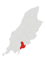
Santon railway station (Manx: Stashoon Raad Yiarn Skylley Stondane) is a request stop near Newtown in the parish of Santon, Isle of Man; it forms part of the sole remaining line of the Isle of Man Railway which once encompassed over 46 miles of network and retains its original station building. The halt sometimes plays host to Santa's Grotto each December as part of the railway's Santa Trains service although between 2010 and 2013 it was not utilised for this purpose. The railway station is situated off the A5 Port Erin to Douglas road, between the railway stations of Ballasalla and Port Soderick.

Excerpt from the Wikipedia article Santon railway station (License: CC BY-SA 3.0, Authors, Images).

Santon railway station
Santon Main Road,

Geographical coordinates (GPS) Address External links Nearby Places
placeShow on map

Wikipedia: Santon railway stationContinue reading on Wikipedia

Geographical coordinates (GPS)

Latitude Longitude
N 54.1182 ° E -4.5841 °
placeShow on map

Address

Santon

Santon Main Road

Isle of Man
mapOpen on Google Maps

linkWikiData (Q7420586)
linkOpenStreetMap (1172772629)

Santon station building
Share experience

Nearby Places

Cronk ny Merriu
Cronk ny Merriu

Close to Port Grenaugh, Cronk ny Merriu (English: Hill of the Dead) is one of the remains of promontory forts in the Isle of Man. Cronk ny Merriu was previously considered by historians to be a prehistoric burial place due to its large grass-covered bank and name, literally translating to "Hill of the Dead". The bank and ditch created a defensive promontory fort at Cronk ny Merriu. Later, a rectangular building of Norse style and layout stood here, part of a system of coastal lookout posts used to protect the coastline and to police beach markets. Excavations of Cronk ny Merriu show that there was very little domestic activity, and that the Norse building likely didn't have permanent residency. It's suggested that the longhouse was primarily a building for those at nearby forts to shelter from harsh weather, rather than a place of defence itself. Although no scientific dating has been done, due to the similarities with fortified headlands throughout the Anglo-Celtic isles, archeologists strongly believe that this site dates back to the Celtic Iron Age.Several of the lookout posts, especially in Santon, where Cronk ny Merriu is situated, can be visited using the coastal footpath. The posts were protected with a deep ditch and a rampart strengthed by large stones on their vulnerable landward side. There'd also be a heavily protected gateway, with ramparts built up on either side, for those seeking shelter in the fort.The Scandinavians who arrived in Mann in the eighth and ninth centuries sometimes re-used these Iron Age promontory forts, often obliterating the old domestic quarters with their characteristic rectangular houses; the example at Cronk ny Merriu has been used as the basis of the reconstruction of the House of Manannan museum in Peel.