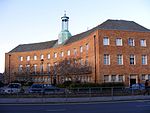
Friern Hospital (formerly Colney Hatch Lunatic Asylum) was a psychiatric hospital in the parish of Friern Barnet close to a crossroads which had a hamlet known as Colney Hatch. In 1965, it became part of the London Borough of Barnet and in the early 21st century was converted to residential housing as Princess Park Manor and Friern Village. The hospital was built as the Second Middlesex County Asylum and was in operation from 1851 to 1993. After the County of London was created in 1889 it continued to serve much of Middlesex and of the newer county, London. During much of this time its smaller prototype Hanwell Asylum also operated.At its height, Colney Hatch was home to 2,500 mental patients and had the longest corridor in Britain (It would take a visitor more than two hours to walk the wards). For much of the 20th century, its name was synonymous among Londoners with any mental institution.
The asylum with its surrounding fields, gardens and recreation grounds adjoined Friern Barnet Road and is shown on the Ordnance Survey map of 1868–1883, which labels the nascent settlement of New Southgate under a popular developers' name Colney Hatch Park. Today that larger community is the core area of New Southgate in the London Borough of Enfield. The map shows the large asylum which resembled closely the new settlement in size. Friern Barnet is today used fairly interchangeably with New Southgate for the area west of the Great Northern Railway – a short path from the asylum led to the station built to serve it, New Southgate railway station, which moved a short distance and remains. The station had five earlier names: the changes demonstrate a gradual erasure of the small place name "Colney Hatch" from the public psyche and in general public use. Colney Hatch was the southern hamlet, centred on a crossroads, of the medieval parish of Friern Barnet which stretched 3 miles (4.8 km) north north-west and was half as wide as long. The very rural parish until the late 19th century had one other main population centre, equally a hamlet, Whetstone.


