Strickland Roger
Civil parishes in CumbriaCumbria geography stubsSouth Lakeland District

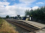
Strickland Roger is a civil parish in South Lakeland, Cumbria, England. In the 2001 census the parish had a population of 544, decreasing at the 2011 census to 480. It lies north of Burneside and west of the A6 road, and is bordered by the parishes of Strickland Ketel to the south west, Nether Staveley and Kentmere to the west, Whitwell and Selside to the north, and Skelsmergh to the east.There are 16 listed buildings or structures in the parish, all at grade II.
Excerpt from the Wikipedia article Strickland Roger (License: CC BY-SA 3.0, Authors, Images).Strickland Roger
Potter Fell Road, South Lakeland Strickland Roger
Geographical coordinates (GPS) Address Nearby Places Show on map
Geographical coordinates (GPS)
| Latitude | Longitude |
|---|---|
| N 54.374935 ° | E -2.770524 ° |
Address
Potter Fell Road
Potter Fell Road
LA8 9AD South Lakeland, Strickland Roger
England, United Kingdom
Open on Google Maps


