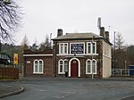
Wrockwardine Wood

Wrockwardine Wood (pronounced "Rock-war-dine") was originally a detached piece of woodland, then a township, formerly belonging to the manor and parish of Wrockwardine. Wrockwardine is located approximately 7 miles west from Wrockwardine Wood. Wrockwardine Wood is located in north east Telford in Shropshire and is bordered by Donnington, St Georges, Trench, The Nabb and Oakengates. The local government parish of Wrockwardine Wood and Trench comprises most of the Church of England parish of Wrockwardine Wood. In the eighteenth century industrial revolution Wrockwardine Wood was inhabited by coal and iron mine workers and their families. So many people had become Primitive Methodists that the Church of England set up a new parish in 1833 and built a very attractive red brick church (Holy Trinity). The 2 Methodist chapels recently closed, being replaced by Oakengates United Church (Methodist and United Reformed Church.)Wrockwardine Wood & Trench Parish Council has a Labour Party majority.
Excerpt from the Wikipedia article Wrockwardine Wood (License: CC BY-SA 3.0, Authors, Images).Wrockwardine Wood
Woodlands Drive,
Geographical coordinates (GPS) Address Nearby Places Show on map
Geographical coordinates (GPS)
| Latitude | Longitude |
|---|---|
| N 52.702 ° | E -2.447 ° |
Address
Woodlands Drive
Woodlands Drive
TF2 6LS , Trench
England, United Kingdom
Open on Google Maps


