place

Eckfelder Maar

Geology stubsLagerstättenMaars of the Eifel
Eckfeldermaar
Eckfeldermaar

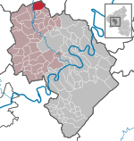
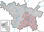
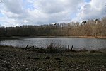
The Eckfelder Maar is a former volcanic lake, that was formed during the Middle Eocene around 44.3 million years ago and is thus the oldest known maar. It lies in the southwestern Eifel mountains near Manderscheid in Germany. It is also an important fossil site that contains numerous fossil remains of fauna and flora, some of them nearly complete state of preservation. It has been continuously scientifically researched since 1987. The large number of finds - to date 25,000 fossil specimens have been found - have enabled a very detailed reconstruction of the landscape. This maar, a low volcanic crater, along with research areas at the Grube Messel and the Geiseltal valley, is one of the foremost palaeontological sites for this geological epoch in Central Europe and worldwide.

Excerpt from the Wikipedia article Eckfelder Maar (License: CC BY-SA 3.0, Authors, Images).

Eckfelder Maar
Lieserpfad, Wittlich-Land

Geographical coordinates (GPS) Address Nearby Places
placeShow on map

Wikipedia: Eckfelder MaarContinue reading on Wikipedia

Geographical coordinates (GPS)

Latitude Longitude
N 50.115555555556 ° E 6.8186111111111 °
placeShow on map

Address

Grabungsstelle Eckfelder Trockenmaar

Lieserpfad
54531 Wittlich-Land
Rhineland-Palatinate, Germany
mapOpen on Google Maps

Eckfeldermaar
Eckfeldermaar
Share experience

Nearby Places

Holzmaar
Holzmaar

The Holzmaar lies in the Volcanic Eifel in the German state of Rhineland-Palatinate almost halfway between Gillenfeld (2.5 km away to the southwest) and Eckfeld. The maar has an area of about 6.8 hectares (17 acres), a diameter of 325 metres (1,066 ft) and a depth of 21 metres (69 ft) and lies within a nature reserve, almost completely surrounded by woods. It is one of the two maars making up the Gillenfeld Maars, the other being the Pulvermaar. The Holzmaar is fed by a headstream of the Sammetbach which crosses the maar. In the immediate vicinity is another maar, the Dürres Maar. On its south and southwest shores, the maar has silted up with sediments, core samples from which give a comprehensive picture of the climate going back to the last cold period. The sediments of the Holzmaar go back 23,200 years. This assessment was made possible by comparing the sequence and radiometric dating obtained in the maar basin with that of the Meerfelder Maar. The time of the maximum of the last glaciation derived from varve chronology is in close agreement with data from the Greenland Ice Sheet Project (GISP2), but are somewhat at odds with those of the Greenland Ice Core Project (GRIP). In the sequence of sediments three zones of strata were found, when the most dust was deposited in the crater lake. If these dust-laden layers correspond to the ice advances of the northern German inland ice sheet, by comparing them with the exact chronological sequence of the dust layers in the Maar sediments an equally accurate age for local terminal moraines may be possible at suitable locations in northern Germany.