Edelareberg
AC with 0 elementsClimbs in cycle racing in BelgiumMountains and hills of East FlandersOudenaardeTour of Flanders

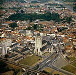
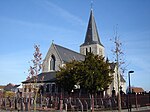
Edelareberg is a hill in Oudenaarde, in the Belgian province of East Flanders. With its top at 80 m, it is one of the many hill formations in the Flemish Ardennes. The top of the Edelareberg is in the village of Edelare, from which the hill takes its name. Colloquially, it is also called Kerselareberg, after Kerselare, the small hamlet which is now part of Edelare. The road was asphalted in the late 1960s and is now a broad and gently rising road, part of the N8 road connecting Oudenaarde and Brakel. The steepest slopes are 7% towards the top of the climb.
Excerpt from the Wikipedia article Edelareberg (License: CC BY-SA 3.0, Authors, Images).Edelareberg
Edelareberg,
Geographical coordinates (GPS) Address Nearby Places Show on map
Geographical coordinates (GPS)
| Latitude | Longitude |
|---|---|
| N 50.83266 ° | E 3.6257 ° |
Address
Edelareberg
Edelareberg
9700
East Flanders, Belgium
Open on Google Maps


