place

Queen Victoria Bridge

1881 establishments in ScotlandBridges completed in 1881Bridges in AberdeenUnited Kingdom bridge (structure) stubsUse British English from March 2016
Victoria Bridge
Victoria Bridge

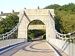
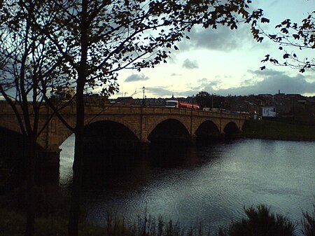
Queen Victoria Bridge, also known as Victoria Bridge, is a road bridge across the River Dee linking the main part of the City of Aberdeen with Torry and the southern areas of the city. It was opened in May 1881. Built by Aberdeen City Council and partly funded by public subscription, it was constructed partly in response to the River Dee ferryboat disaster of 5 April 1876.

Excerpt from the Wikipedia article Queen Victoria Bridge (License: CC BY-SA 3.0, Authors, Images).

Queen Victoria Bridge
Victoria Bridge, Aberdeen City Balnagask

Geographical coordinates (GPS) Address External links Nearby Places
placeShow on map

Wikipedia: Queen Victoria BridgeContinue reading on Wikipedia

Geographical coordinates (GPS)

Latitude Longitude
N 57.140032 ° E -2.089541 °
placeShow on map

Address

Victoria Bridge

Victoria Bridge
AB11 9DR Aberdeen City, Balnagask
Scotland, United Kingdom
mapOpen on Google Maps

linkWikiData (Q17770774)
linkOpenStreetMap (570396312)

Victoria Bridge
Victoria Bridge
Share experience

Nearby Places

March Stones of Aberdeen

The March Stones of Aberdeen are boundary marker stones encircling the land owned by the Scottish royal burgh, dating from before 1525. In the 1300s Robert the Bruce granted the Royal Burgh of Aberdeen unusually strong rights over the burgh itself and the open lands outside the city. The land was valuable and so the boundary was marked out by the March Stones, "march" being the word used to describe a border area. In their first incarnation the March Stones were large standing stones and the boundary line was augmented with cairns or it ran along natural features such as streams. Because Aberdeen is an eastern coastal town the 26-mile (42 km) line of stones only encircled it to the west. To discourage encroachment the bounds were regularly ridden around by burgesses in the "riding of the marches", the Scots equivalent of beating the bounds, but eventually this became merely a ceremonial matter. The area marked out, the so-called Freedom Lands of Aberdeen, lay outside the "City Royalty" – the urban area itself and the crofts just on its outskirts. One line of outer stones ran along the outer boundary of the Freedom Lands and a second line, the inner stones, was added in the early 19th century, marking the division of the royalty from the Freedom Lands. The March Stones of Aberdeen were first written about in 1525 in connection with a riding of the marches. As time went by the stones themselves became marked for identification and between 1790 and 1810 new stones were installed with inscribed sequence numbers, sometimes alongside the earlier ones. Most of these later stones are still to be found although some are later replacements.