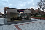
Hellín (Madrid)
AC with 0 elementsMadrid geography stubsSan Blas-CanillejasWards of Madrid

Hellín is an administrative neighborhood (barrio) of Madrid belonging to the district of San Blas-Canillejas. It has an area of 0.549031 km2 (0.211982 sq mi). As of 1 March 2020, it has a population of 9,403.
Excerpt from the Wikipedia article Hellín (Madrid) (License: CC BY-SA 3.0, Authors, Images).Hellín (Madrid)
Calle de la Taquigrafía, Madrid San Blas - Canillejas (San Blas - Canillejas)
Geographical coordinates (GPS) Address Nearby Places Show on map
Geographical coordinates (GPS)
| Latitude | Longitude |
|---|---|
| N 40.430277777778 ° | E -3.6188888888889 ° |
Address
CEIP Ramón María del Valle Inclán
Calle de la Taquigrafía
28037 Madrid, San Blas - Canillejas (San Blas - Canillejas)
Community of Madrid, Spain
Open on Google Maps


