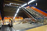
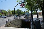
Ambroz (Madrid)
Madrid geography stubsVicálvaroWards of Madrid

Ambroz was an administrative neighborhood (barrio) of Madrid belonging to the district of Vicálvaro (one of the district's two constituent neighborhoods together with Casco Histórico). In 2017, through approval of Madrid's city council, the territory became part of the Casco Histórico de Vicálvaro neighborhood.
Excerpt from the Wikipedia article Ambroz (Madrid) (License: CC BY-SA 3.0, Authors, Images).Ambroz (Madrid)
Carretera de Vicálvaro a la Estación de O'Donnell, Madrid
Geographical coordinates (GPS) Address Nearby Places Show on map
Geographical coordinates (GPS)
| Latitude | Longitude |
|---|---|
| N 40.416666666667 ° | E -3.5833333333333 ° |
Address
Carretera de Vicálvaro a la Estación de O'Donnell
Carretera de Vicálvaro a la Estación de O'Donnell
28821 Madrid (San Blas - Canillejas)
Community of Madrid, Spain
Open on Google Maps


