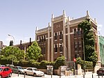
Numancia (Madrid)
Madrid geography stubsPuente de VallecasWards of Madrid

Numancia is an administrative neighborhood (barrio) of Madrid belonging to the district of Puente de Vallecas. It has an area of 1.849172 km2 (0.713969 sq mi). As of 1 March 2020, it has a population of 48,815.
Excerpt from the Wikipedia article Numancia (Madrid) (License: CC BY-SA 3.0, Authors, Images).Numancia (Madrid)
Calle de Montseny, Madrid Vallecas
Geographical coordinates (GPS) Address Nearby Places Show on map
Geographical coordinates (GPS)
| Latitude | Longitude |
|---|---|
| N 40.400833333333 ° | E -3.6630555555556 ° |
Address
Colegio Asunción - Vallecas
Calle de Montseny 25
28038 Madrid, Vallecas
Community of Madrid, Spain
Open on Google Maps


