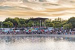
Orcasur
Madrid geography stubsUseraWards of Madrid

Orcasur is an administrative neighborhood (barrio) of Madrid belonging to the district of Usera. It has an area of 1.384234 km2 (0.534456 sq mi). As of 1 March 2020, it has a population of 14,264. The Hospital Universitario 12 de Octubre is located in the neighborhood.
Excerpt from the Wikipedia article Orcasur (License: CC BY-SA 3.0, Authors, Images).Orcasur
Calle de Illora, Madrid Usera
Geographical coordinates (GPS) Address Nearby Places Show on map
Geographical coordinates (GPS)
| Latitude | Longitude |
|---|---|
| N 40.367222222222 ° | E -3.6991666666667 ° |
Address
Calle de Illora
Calle de Illora
28041 Madrid, Usera
Community of Madrid, Spain
Open on Google Maps


