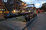
Puerta Bonita (Madrid)
AC with 0 elementsCarabanchelMadrid geography stubsWards of Madrid

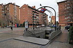
Puerta Bonita is an administrative neighborhood (barrio) of Madrid belonging to the district of Carabanchel. It has an area of 1.607994 km2 (0.620850 sq mi). With an area of 0.45 km2 (0.17 sq mi), the Quinta of Vistalegre (a former Royal Site), which is chiefly owned by the regional administration, spreads over much of the neighborhood. The name of the neighborhood (Spanish for "beautiful gate") comes from a former iron gate of the quinta, which was accidentally destroyed in 1982. As of 1 February 2020, it has a population of 36,157.
Excerpt from the Wikipedia article Puerta Bonita (Madrid) (License: CC BY-SA 3.0, Authors, Images).Puerta Bonita (Madrid)
Parque Vista Alegre, Madrid Carabanchel
Geographical coordinates (GPS) Address Nearby Places Show on map
Geographical coordinates (GPS)
| Latitude | Longitude |
|---|---|
| N 40.381944444444 ° | E -3.7363888888889 ° |
Address
I.E.S Vista Alegre
Parque Vista Alegre 177
28025 Madrid, Carabanchel
Community of Madrid, Spain
Open on Google Maps


