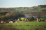
Shirland and Higham
Civil parishes in DerbyshireNorth East Derbyshire District

Shirland and Higham is a civil parish within the North East Derbyshire district, which is in the county of Derbyshire, England. Mainly built up with rural fringes, its population was 4,802 residents in the 2011 census. The parish is 120 miles (190 km) north west of London, 14 miles (23 km) north east of the county city of Derby, and 1+3⁄4 miles (2.8 km) north of the nearest market town of Alfreton. It shares a boundary with the parishes of Alfreton, Blackwell, Brackenfield, Morton, South Normanton, South Wingfield, Stretton, Tibshelf and Wessington.
Excerpt from the Wikipedia article Shirland and Higham (License: CC BY-SA 3.0, Authors, Images).Shirland and Higham
Strettea Lane, North East Derbyshire Shirland and Higham CP
Geographical coordinates (GPS) Address Nearby Places Show on map
Geographical coordinates (GPS)
| Latitude | Longitude |
|---|---|
| N 53.124 ° | E -1.415 ° |
Address
Strettea Lane
Strettea Lane
DE55 6BQ North East Derbyshire, Shirland and Higham CP
England, United Kingdom
Open on Google Maps


