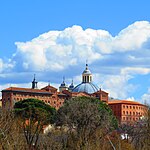
Muslim Walls of Madrid

The Muslim Walls of Madrid (also known as the Arab Walls of Madrid), of which some vestiges remain, are located in the Spanish city of Madrid. They are probably the oldest construction extant in the city. They were built in the 9th century, during the Muslim domination of the Iberian Peninsula, on a promontory next to Manzanares river. They were part of a fortress around which developed the urban nucleus of Madrid. They were declared an Artistic-Historic Monument in 1954.The remains of utmost importance, with more archaeological than artistic interest, are in the Cuesta de la Vega, next to the crypt of the Almudena Cathedral. They were built in the park of Mohamed I, named in reference to Muhammad I of Córdoba, considered the founder of the city. Along the Calle Mayor street, at number 83, next to the Viaduct that serves the Calle de Segovia, are still standing the ruins of the Tower of Narigües, which probably would have been an albarrana tower, with a separate location from the main wall itself, but connected thereto by a minor wall. Its function was to serve as a viewpoint. In the 20th century, some remains were destroyed. The rest once existing near number 12 Calle de Bailén were lost with the construction of an apartment block, although some walls were integrated into the building structure as its foundation. The remodeling of the Plaza de Oriente, completed in 1996 during the mayoral term of José María Álvarez del Manzano, meant the discovery and subsequent disappearance of numerous remains. This was not the case with the watchtower known as Tower of the Bones, whose base is on display in the underground car park of the same plaza.Between 1999 and 2000, another section was uncovered, about 70 metres (230 ft) long, under the Plaza de la Armería, formed by the main façades of the Royal Palace and Almudena Cathedral. It was excavated during the construction work of the Museum of Royal Collections (unfinished) and may correspond to the Puerta de la Sagra, one of the gates to the walled enclosure.
Excerpt from the Wikipedia article Muslim Walls of Madrid (License: CC BY-SA 3.0, Authors, Images).Muslim Walls of Madrid
Cuesta de la Vega, Madrid
Geographical coordinates (GPS) Address Nearby Places Show on map
Geographical coordinates (GPS)
| Latitude | Longitude |
|---|---|
| N 40.4148 ° | E -3.7157 ° |
Address
Cuesta de la Vega
Cuesta de la Vega
28013 Madrid (Centro)
Community of Madrid, Spain
Open on Google Maps


