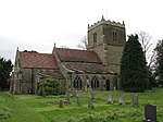
Scarrington
Civil parishes in NottinghamshireEngvarB from July 2016RushcliffeVillages in Nottinghamshire

Scarrington is an English civil parish and village in the Rushcliffe borough of Nottinghamshire, adjacent to Bingham, Car Colston, Hawksworth, Orston and Aslockton. Its 973 acres (394 ha) had a population in 2011 of 183. It lies at Ordnance Survey grid reference SK7341 in the undulating farmland of the Vale of Belvoir, some 2 miles (3.2 km) from the town of Bingham and from a stretch of the Roman Fosse Way (A46) between Newark and Leicester. It is skirted by the A52 road between Nottingham and Grantham.
Excerpt from the Wikipedia article Scarrington (License: CC BY-SA 3.0, Authors, Images).Scarrington
Aslockton Road, Rushcliffe Scarrington
Geographical coordinates (GPS) Address Nearby Places Show on map
Geographical coordinates (GPS)
| Latitude | Longitude |
|---|---|
| N 52.965834 ° | E -0.906966 ° |
Address
Aslockton Road
NG13 9BP Rushcliffe, Scarrington
England, United Kingdom
Open on Google Maps


