place

Woodham Walter Common SSSI

Sites of Special Scientific Interest in Essex
Woodham Walter Common geograph.org.uk 1382413

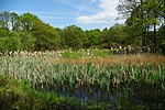
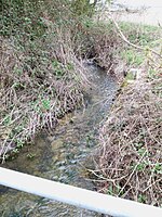
Woodham Walter Common SSSI is an 80-hectare (200-acre) biological Site of Special Scientific Interest (SSSI) in Danbury in Essex. The site includes six nature reserves within the Danbury Ridge Nature Reserves, managed by the Essex Wildlife Trust. These are Woodham Walter Common itself, Birch Wood, Pheasanthouse Wood, Poors' Piece, Scrubs Wood and a small area in Pheasanthouse Farm. The largest part of the SSSI is the 32.3-hectare (80-acre) Woodham Walter Common, which is managed by the Wildlife Trust on behalf of Maldon District Council and Woodham Walter Parish Council.The site is on glacial sand and gravel over London clay. it has a number of areas of oak and hornbeam woodland on former heathland. It also has two botanically rich valleys, each of which has a stream along it. Poors' Piece and Pheasanthouse Wood have ancient woodland. Uncommon ground plants are pill sedge, broad-leaved helleborine and lady-fern. There are common brimstone and speckled wood butterflies, nightingales, hawfinches, badgers. and dormice.There is access to Woodham Walter Common from Common Lane.

Excerpt from the Wikipedia article Woodham Walter Common SSSI (License: CC BY-SA 3.0, Authors, Images).

Woodham Walter Common SSSI
Postmans Lane, Chelmsford Little Baddow

Geographical coordinates (GPS) Address Nearby Places
placeShow on map

Wikipedia: Woodham Walter Common SSSIContinue reading on Wikipedia

Geographical coordinates (GPS)

Latitude Longitude
N 51.7246 ° E 0.5895 °
placeShow on map

Address

Postmans Lane

Postmans Lane
CM3 4UJ Chelmsford, Little Baddow
England, United Kingdom
mapOpen on Google Maps

Woodham Walter Common geograph.org.uk 1382413
Share experience

Nearby Places

List of local nature reserves in Essex

Essex is a county in the east of England. It is bounded by Suffolk and Cambridgeshire to the north, Hertfordshire to the west, Greater London to the south-west, Kent across the River Thames to the south, and the North Sea to the east. It has an area of 1,420 square miles (3,700 km2), with a coastline of 400 miles (640 km), and a population according to the 2011 census of 1,393,600. At the top level of local government are Essex County Council and two unitary authorities, Southend-on-Sea and Thurrock. Under the county council, there are twelve district and borough councils.Local nature reserves (LNRs) are designated by local authorities under the National Parks and Access to the Countryside Act 1949. The local authority must have legal control over the site, by owning or leasing it or having an agreement with the owner. LNRs are sites which have a special local interest either biologically or geologically, and local authorities have a duty to care for them. They can apply local bye-laws to manage and protect LNRs.As of August 2016 there are forty-nine local nature reserves in Essex. Nine are also Sites of Special Scientific Interest (SSSI), three are also scheduled monuments and four are managed by the Essex Wildlife Trust. The largest is Southend-on-Sea Foreshore with 1,084 hectares (2,680 acres), which is part of the Benfleet and Southend Marshes SSSI, an internationally important site for migrating birds. The smallest is Nazeing Triangle at 0.5 hectares (1.2 acres), which is a small pond and wildflower meadows surrounded on all three sides by roads.