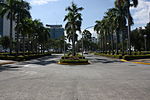
Putatan, Muntinlupa
Barangays of Metro ManilaMuntinlupa

Putatan is a barangay in Muntinlupa, Metro Manila, Philippines. The total land area of the barangay is 6.746 km2. According to the 2020 census, it has a population of 99,725. Putatan is located at the south of the City of Manila. It is bounded by barangays Alabang and Bayanan on the north, Laguna de Bay on the east, the Muntinlupa Poblacion on the south; and barangay Ayala Alabang on the west. The barangay is also home to the city hall of Muntinlupa and its several departments.
Excerpt from the Wikipedia article Putatan, Muntinlupa (License: CC BY-SA 3.0, Authors, Images).Putatan, Muntinlupa
Tulip Street, Muntinlupa
Geographical coordinates (GPS) Address Nearby Places Show on map
Geographical coordinates (GPS)
| Latitude | Longitude |
|---|---|
| N 14.398366666667 ° | E 121.03637777778 ° |
Address
Tulip Street
Tulip Street
1772 Muntinlupa
Philippines
Open on Google Maps


