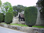
Blowing Stone
Anglo-Saxon archaeologyArchaeological sites in OxfordshireHistory of BerkshireStone Age sites in EnglandStones ... and 2 more
Tourist attractions in OxfordshireVale of White Horse

The Blowing Stone is a perforated sarsen at grid reference SU32412 87083 in Kingston Lisle, which is in the traditional county of Berkshire, but is currently administered as part of Oxfordshire. The stone is in a garden at the foot of Blowingstone Hill just south of the Icknield Way (B4507), about 4+1â2 miles (7 km) west of Wantage and about 1+1â2 miles (2.4 km) east of White Horse Hill. Blowingstone Hill is part of the escarpment of the Berkshire Downs, at the crest of which is The Ridgeway.
Excerpt from the Wikipedia article Blowing Stone (License: CC BY-SA 3.0, Authors, Images).Blowing Stone
Blowingstone Hill, Vale of White Horse
Geographical coordinates (GPS) Address Nearby Places Show on map
Geographical coordinates (GPS)
| Latitude | Longitude |
|---|---|
| N 51.581686 ° | E -1.533622 ° |
Address
Blowingstone Hill
Blowingstone Hill
OX12 9QE Vale of White Horse
England, United Kingdom
Open on Google Maps


