place

Ealing Common

1733 establishments in EnglandCommon land in LondonCricket grounds in MiddlesexCricket in MiddlesexDefunct cricket grounds in England
Defunct sports venues in LondonDistricts of the London Borough of EalingEnglish cricket venues in the 18th centuryHistory of MiddlesexMiddlesexParks and open spaces in the London Borough of EalingSport in LondonSports venues completed in 1733Sports venues in London
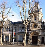
Ealing Common geograph.org.uk 17075

Ealing Common is a large open space (approx 47 acres or 19 hectares) in Ealing, West London.

Excerpt from the Wikipedia article Ealing Common (License: CC BY-SA 3.0, Authors, Images).

Ealing Common
Warwick Road, London Acton (London Borough of Ealing)

Geographical coordinates (GPS) Address Nearby Places
placeShow on map

Wikipedia: Ealing CommonContinue reading on Wikipedia

Geographical coordinates (GPS)

Latitude Longitude
N 51.51 ° E -0.294 °
placeShow on map

Address

Warwick Road

Warwick Road
W5 3JG London, Acton (London Borough of Ealing)
England, United Kingdom
mapOpen on Google Maps

Ealing Common geograph.org.uk 17075
Share experience

Nearby Places

Ealing
Ealing

Ealing () is a district in West London, England. It is 7.5 miles (12.1 km) west of Charing Cross. In the London Borough of Ealing, it is one of the borough's seven major towns (alongside Acton, Greenford, Hanwell, Northolt, Perivale and Southall). Ealing, resembling the W5, W13 and NW10 post codes is the administrative centre of the borough. It is identified as a major metropolitan centre in the London Plan.Ealing is in the historic county of Middlesex. Until the urban expansion of London in the late 19th century and early 20th centuries, Ealing was a rural village within Ealing parish. Improvement in communications with London, culminating with the opening of the railway station in 1838, shifted the local economy to market garden supply and eventually to suburban development. By 1902 Ealing had become known as the "Queen of the Suburbs" due to its greenery, and because it was halfway between city and country.As part of the growth of London in the 20th century, Ealing significantly expanded and increased in population. It became a municipal borough in May 1901 and has formed part of Greater London since December 1965. It is now a significant commercial and retail centre with a developed night-time economy. Ealing has the characteristics of both leafy suburban and inner-city development. The Pitshanger neighbourhood and some others retain the lower density, greenery and architecture of suburban villages. Ealing's town centre is often referred to as Ealing Broadway, the name of both a railway interchange and a shopping centre. Most of Ealing, including the commercial district, South Ealing, Ealing Common, Montpelier, Pitshanger and most of Hanger Hill fall under the W5 postcode. Areas to the north-west of the town centre such as Argyle Road and West Ealing fall under W13 instead. A small section north-east of the town centre, near Hanger Hill, falls under the NW10 postcode area. The population of Ealing (including Northfields) was 85,014 in the 2011 census.

Ealing Common Depot
Ealing Common Depot

Ealing Common Depot is a London Underground railway depot on the District line, located between Acton Town and Ealing Common stations in west London, England. It is the oldest of the main depots on the Underground, having been built in 1905, when the District Railway was upgraded for electric traction. All depot facilities were moved there from Lillie Bridge Depot, and it was known as Mill Hill Park Works. It subsequently became Ealing Common Works, and its status was reduced to that of a depot in 1922, when Acton Works was opened, and took over responsibility for all major overhauls. Most of the functions of Acton Works were devolved back to the depots, including Ealing Common, in 1985. Extensive remodelling of the tracks around the depot took place in the 1930s, when the route from Acton Town to Northfields was quadrupled, and the local eastbound track from South Ealing station tunnels under some of the sidings in the depot. In 1990, a heavy repair shop was built at the southern end of the depot, but this function was transferred back to Acton Works, and the building is now used for storage of artefacts for the London Transport Museum. Access to the depot by rail can be gained from both tracks at Ealing Common station, where the junction is to the south of the platforms. At the southern end of the depot, a steep incline leads down to the two eastbound platforms at Acton Town station. Road access is from the A4020 Uxbridge Road at the north end, and a service road from the A4000 Gunnersbury Lane leads to the museum depot. One of the first uses of the depot in 1905 was the storage of redundant steam locomotives, displaced by the new electric multiple units, pending disposal, and a regular steam service between Lillie Bridge and the depot operated for many years, for the transfer of stores. From 1932 a small number of Piccadilly line trains were also stored at the depot, and a small number of District line trains were stored at Northfields Depot, but this practice ended in 1964. The depot is now used for the storage of trains for the District line, and the number of trains required has steadily increased. It also carries out engineering work, and the final commissioning of the D78 Stock took place at the depot from 1979.