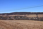
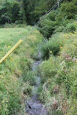
Roaring Creek is a tributary of the Susquehanna River in Columbia County and Montour County, in Pennsylvania, in the United States. It is slightly more than 20 miles (32 km) long and flows through Roaring Creek Township, Locust Township, Catawissa Township, Cleveland Township, and Franklin Township in Columbia County and Mayberry Township in Montour County. The watershed of the creek has an area of 87.3 square miles (226 km2). It has three named tributaries: South Branch Roaring Creek, Lick Run, and Mill Creek. The creek is not considered to be impaired and is not affected by coal mining. However, its watershed has been impacted by human land use. Claystones, conglomerates, sandstones, siltstones, and shales all occur within the watershed. The creek flows through a gorge in its lower reaches, along the border between Columbia County and Montour County.
Most of the watershed of Roaring Creek is in Columbia County, but small areas are in Montour County, Northumberland County, and Schuylkill County. More than 40 percent of the watershed is forested and nearly 40 percent is agricultural land. State game lands and state forests are also in the watershed. A total of approximately 3,500 people inhabit the watershed, as of 2000. The creek's drainage basin is a High-Quality Coldwater Fishery and a Migratory Fishery upstream of Lick Run. Downstream of Lick Run, the main stem is a Trout Stocked Fishery and Migratory Fishery. A reach of the creek above Lick Run is designated as Class A Wild Trout Waters. 31 species of fish were observed at 20 sites in the watershed in 2003 and 2004.
Roaring Creek was historically known as Popemetang, but it was known as Roaring Creek by the late 1700s. Settlers such as Quakers first arrived in the area in the 1770s. In the 19th century, various mills and furnaces were constructed on the creek and several bridges were constructed. Agriculture was also a major industry in the watershed in the early 20th century. More bridges were constructed across the creek in the 20th century. The Roaring Creek Valley Conservation Association formed in February 2006. Part of the creek is navigable by canoe.


