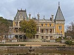
Yalta Municipality
Municipalities of CrimeaPages with non-numeric formatnum argumentsYalta Municipality

Yalta City Municipality (Russian: Я́лтинский городско́й сове́т; Ukrainian: Я́лтинська міська́ ра́да; Crimean Tatar: Yalta şeer şurası, Ялта шеэр шурасы), officially "the territory governed by the Yalta city council", also known as Greater Yalta (Russian: Большая Ялта) is one of the 25 regions of the Autonomous Republic of Crimea, a territory recognized by a majority of countries as part of Ukraine but forcibly incorporated into Russia after Russia invaded Ukraine in 2014. It is a resort region, located at the southern shore of Crimea – one of the most famous recreational territories of the former Soviet Union. Population: 133,675 (2014 Census).
Excerpt from the Wikipedia article Yalta Municipality (License: CC BY-SA 3.0, Authors, Images).Yalta Municipality
Moskovskaya Street,
Geographical coordinates (GPS) Address Nearby Places Show on map
Geographical coordinates (GPS)
| Latitude | Longitude |
|---|---|
| N 44.499444444444 ° | E 34.17 ° |
Address
Moskovskaya Street 13
298603
Republic of Crimea, Russia
Open on Google Maps


