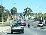
Clarence Gardens, South Australia
Clarence Gardens is an inner southern suburb of Metropolitan Adelaide, South Australia in the City of Mitcham, 4.6 kilometres south of the City Centre. It is bounded to the north by Cross Road, the west by South Road, the east by Winston Avenue and the south by Edward Street. There are many sporting venues in Clarence Gardens which include the Clarence Gardens Lawn Bowls club and the Clarence Gardens Rugby club, both of which are in the A.A. Bailey Recreational Ground facility. Clarence Gardens Post Office opened on 1 August 1946. It was renamed Clarence Gardens North in 1967 on the same day Edwardstown office (open since 1850) was renamed Clarence Gardens. The Clarence Gardens North office closed in 1980 and Clarence Gardens reverted to Edwardstown in 1987.
Excerpt from the Wikipedia article Clarence Gardens, South Australia (License: CC BY-SA 3.0, Authors).Clarence Gardens, South Australia
Avenue Road, Adelaide Clarence Gardens
Geographical coordinates (GPS) Address Nearby Places Show on map
Geographical coordinates (GPS)
| Latitude | Longitude |
|---|---|
| N -34.972 ° | E 138.578 ° |
Address
Avenue Road
Avenue Road
5039 Adelaide, Clarence Gardens
South Australia, Australia
Open on Google Maps


