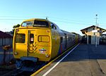
Edwardstown, South Australia

Edwardstown is an inner southern-western suburb located 6 km southwest of Adelaide in the City of Marion. In 1989 the suburb of Edwardstown was split, with the portion east of South Road becoming Melrose Park. This occurred as the suburb was quite large, located on either side of South Road and was in the jurisdiction of two local government councils, with the larger western side belonging to the City of Marion. Edwardstown is in the South Australian House of Assembly districts of Badcoe and Elder, and the Australian House of Representatives Division of Boothby. Edwardstown is home to the Castle Plaza Shopping Centre. Edwardstown is served by the Woodlands Park and Edwardstown railway stations. The current suburb of Edwardstown includes localities previously known as Hammersmith, Woodlands Park, St Mary's West, Ackland Gardens and Mirreen.
Excerpt from the Wikipedia article Edwardstown, South Australia (License: CC BY-SA 3.0, Authors, Images).Edwardstown, South Australia
Raglan Avenue, Adelaide Edwardstown
Geographical coordinates (GPS) Address Nearby Places Show on map
Geographical coordinates (GPS)
| Latitude | Longitude |
|---|---|
| N -34.98 ° | E 138.571 ° |
Address
Raglan Avenue
Raglan Avenue
5039 Adelaide, Edwardstown
South Australia, Australia
Open on Google Maps


