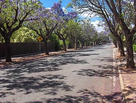
Clarence Park, South Australia
Accuracy disputes from March 2022Adelaide geography stubsPopulated places established in 1892Suburbs of AdelaideUse Australian English from August 2019

Clarence Park (formerly Goodwood South) is an inner southern suburb of Adelaide, South Australia in the City of Unley. Its borders are Mills Street (north), Goodwood Road (east), Cross Road (south) and the Seaford railway line (north-west).
Excerpt from the Wikipedia article Clarence Park, South Australia (License: CC BY-SA 3.0, Authors, Images).Clarence Park, South Australia
Francis Street, Adelaide Clarence Park
Geographical coordinates (GPS) Address Nearby Places Show on map
Geographical coordinates (GPS)
| Latitude | Longitude |
|---|---|
| N -34.963 ° | E 138.586 ° |
Address
Francis Street
Francis Street
5034 Adelaide, Clarence Park
South Australia, Australia
Open on Google Maps


