place

North York

1922 establishments in Ontario1998 disestablishments in OntarioFormer cities in OntarioFormer municipalities in TorontoMetropolitan Toronto
North YorkPopulated places disestablished in 1998Populated places established in 1922Use mdy dates from June 2018
North York Locator
North York Locator

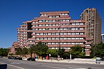
North York is a former township and city and is now one of the six administrative districts of Toronto, Ontario, Canada. It is located in the northern area of Toronto, centred around Yonge Street, north of Ontario Highway 401. It is bounded by York Region to the north at Steeles Avenue, on the west by the Humber River, on the east by Victoria Park Avenue. Its southern boundary corresponds to the northern boundaries of the former municipalities of Toronto: York, Old Toronto and East York. As of the 2016 Census, the district has a population of 644,685.North York was created as a township in 1922 out of the northern part of the former township of York, a municipality that was located along the western border of Old Toronto. Following its inclusion in Metropolitan Toronto in 1953, it was one of the fastest-growing parts of the region due to its proximity to Old Toronto. It was declared a borough in 1967, and later became a city in 1979, attracting high-density residences, rapid transit, and a number of corporate headquarters in North York City Centre, its central business district. In 1998, North York was dissolved as part of the amalgamation which created the new city of Toronto. It has since been a secondary economic hub of the city outside Downtown Toronto.

Excerpt from the Wikipedia article North York (License: CC BY-SA 3.0, Authors, Images).

North York
Yonge Street, Toronto North York (North York)

Geographical coordinates (GPS) Address Nearby Places
placeShow on map

Wikipedia: North YorkContinue reading on Wikipedia

Geographical coordinates (GPS)

Latitude Longitude
N 43.761944444444 ° E -79.410277777778 °
placeShow on map

Address

Yonge Sheppard Centre

Yonge Street
M2N 5N2 Toronto, North York (North York)
Ontario, Canada
mapOpen on Google Maps

North York Locator
North York Locator
Share experience

Nearby Places

Government of Canada Building (North York)

The Joseph Shepard Building (French: Édifice Joseph-Shepard), also known as the Joseph Shepard Federal Building, Government of Canada Building, or simply 4900 Yonge, is an office complex used by the federal government of Canada in Toronto, Ontario, Canada. Located on Yonge Street in the North York neighbourhood of Lansing, the building lies within North York City Centre. Built in 1977 as a medium-sized, planned consolidation project to service residents of the former Metropolitan Toronto districts of North York and Etobicoke, the building houses offices for passport services, Service Canada, Employment and Social Development Canada, Immigration, Refugees and Citizenship Canada, and Canadian Forces recruiting centre in addition to other federal departments. The building was designed by Macy DuBois and is a Classified Federal Heritage Building. The building is named for Joseph Shepard, an early settler in North York whom acquired 400 acres (160 ha) of land nearby and also the namesake of Sheppard Avenue. The structure, with its multi-layered design, stands out among the surrounding skyscrapers along Yonge Street, which were built during the office boom of the 1990s surrounding the diversification of North York City Centre. The building is within walking distance to Sheppard–Yonge subway station and short distance from Ontario Highway 401. The building is one of two buildings used by the federal government in North York, the other being the Environment and Climate Change Canada Building near York University Heights. Other federal facilities in Toronto include the Dominion Public Building, the Canada Centre Building, and the Health Canada Building; the latter two buildings located in the former city of Scarborough.