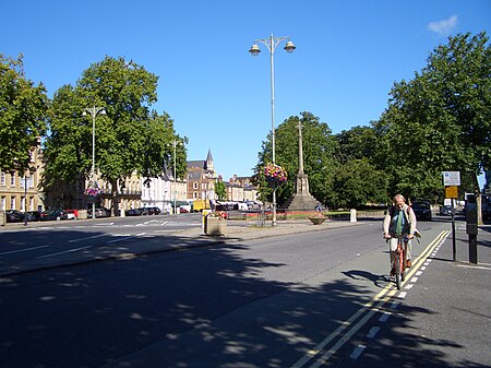
St Giles', Oxford
Balliol College, OxfordOdonyms referring to religionParks and open spaces in OxfordSt Cross College, OxfordSt John's College, Oxford ... and 2 more
Streets in OxfordUse British English from December 2017

St Giles' is a wide boulevard leading north from the centre of Oxford, England. At its northern end, the road divides into Woodstock Road to the left and Banbury Road to the right, both major roads through North Oxford. At the southern end, the road continues as Magdalen Street at the junction with Beaumont Street to the west. Also to the west halfway along the street is Pusey Street. Like the rest of North Oxford, much of St Giles' is owned by St John's College.
Excerpt from the Wikipedia article St Giles', Oxford (License: CC BY-SA 3.0, Authors, Images).St Giles', Oxford
St Giles', Oxford City Centre
Geographical coordinates (GPS) Address Nearby Places Show on map
Geographical coordinates (GPS)
| Latitude | Longitude |
|---|---|
| N 51.7569 ° | E -1.2597 ° |
Address
St Giles'
St Giles'
OX1 2LA Oxford, City Centre
England, United Kingdom
Open on Google Maps


