Reyran

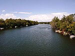
The Reyran is a torrent of the Var department in Provence-Alpes-Côte d'Azur, France and a tributary of the Argens. It is an ephemeral stream, 26.8 km long, which originates in Bagnols-en-Forêt in the Var, 12 km from Fréjus. The Reyran flows only three months a year and can be dry the rest of the year. Its flow is very irregular. The annual rate is 22.70 million m3 and once every 30 years reaches to only 15.75 million m3. The rate is highest during the months of December, January and April. The flow rate is sometimes zero during July and August. During the summer months, the river bed may present a series of isolated ponds that decrease in size by the day. The bed of the Reyran is made of coarse sand and gravel up to 30–40 cm. Their lithology is that of surrounding rocks: sandstone, gneiss, pegmatite, volcanic rocks.
Excerpt from the Wikipedia article Reyran (License: CC BY-SA 3.0, Authors, Images).Reyran
Rue des Batteries, Draguignan
Geographical coordinates (GPS) Address Nearby Places Show on map
Geographical coordinates (GPS)
| Latitude | Longitude |
|---|---|
| N 43.4105 ° | E 6.7338 ° |
Address
Rue des Batteries
83600 Draguignan
Provence-Alpes-Côte d'Azur, France
Open on Google Maps


