Kanata, Ontario
All pages needing cleanupFormer cities in OntarioFormer municipalities now in OttawaHigh-technology business districts in CanadaNeighbourhoods in Ottawa ... and 4 more
Pages with non-numeric formatnum argumentsPopulated places disestablished in 2000Use Canadian English from January 2023Wikipedia introduction cleanup from February 2013

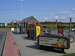
Kanata (, kə-NAT-ə) is a suburban district in Ottawa, Ontario, Canada. It is located about 22 km (14 mi) west of the city's downtown core. As of 2021, Kanata had an urban population of 137,118. Before it was amalgamated into Ottawa in 2001, it was one of the fastest-growing cities in Canada and the fastest-growing community in Eastern Ontario. Located just to the west of the National Capital Commission Greenbelt, it is one of the largest of several communities that surround central Ottawa.
Excerpt from the Wikipedia article Kanata, Ontario (License: CC BY-SA 3.0, Authors, Images).Kanata, Ontario
March Road, Ottawa Kanata
Geographical coordinates (GPS) Address Nearby Places Show on map
Geographical coordinates (GPS)
| Latitude | Longitude |
|---|---|
| N 45.333333333333 ° | E -75.9 ° |
Address
March Road
March Road
K2K 1N8 Ottawa, Kanata
Ontario, Canada
Open on Google Maps


