place

Hoogblokland

Former municipalities of South HollandMolenlandenPopulated places in South HollandSouth Holland geography stubs
Map NL Giessenlanden Hoogblokland

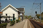
Hoogblokland is a village in the Dutch province of South Holland. It is a part of the municipality of Molenlanden, and lies about 4 km north of Gorinchem. In 2001, the village of Hoogblokland had 935 inhabitants. The built-up area of the village was 0.25 km², and contained 372 residences. The statistical area "Hoogblokland", which also can include the peripheral parts of the village, as well as the surrounding countryside, has a population of around 1100.Hoogblokland was a separate municipality until 1986, when it became a part of Giessenlanden.

Excerpt from the Wikipedia article Hoogblokland (License: CC BY-SA 3.0, Authors, Images).

Hoogblokland
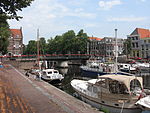
Vlietskade, Molenlanden

Geographical coordinates (GPS) Address Nearby Places
placeShow on map

Wikipedia: HoogbloklandContinue reading on Wikipedia

Geographical coordinates (GPS)

Latitude Longitude
N 51.866666666667 ° E 4.9833333333333 °
placeShow on map

Address

Vlietskade 1068
4241 WC Molenlanden (Gorinchem)
South Holland, Netherlands
mapOpen on Google Maps

Map NL Giessenlanden Hoogblokland
Share experience

Nearby Places

Linge
Linge

The Linge is a river in the Betuwe that is 99.8 km long, which makes it one of the longest rivers that flow entirely within the Netherlands. The river starts near the village of Doornenburg near the German border. A legend tells us that if pigs no longer forage at the castle of Doornenburg, the river will dry up. The Linge flows to Zoelen, a small village north of Tiel, and from there it meanders west through the Betuwe, to empty in the Boven Merwede near Gorinchem. Until Geldermalsen, the river is little more than a small, canalised stream. From Geldermalsen on, however, it takes the appearance of a real river complete with dikes and small floodplains. The Linge provides idyllic spots at old towns like Asperen and Leerdam as the picturesque city walls are still in place on the banks of the river. The river was once a branch of the river Waal, being cut off at Tiel in 1307 or thereabouts (some traces of this can still be seen). The river is navigable for small vessels and is a popular destination for boaters. The banks of the river are important breeding grounds for waterfowl. This river used to be an important trade route in the olden days. This role has subsequently been taken over by the Rhine and Waal rivers. Railroad bridges (with nearest train station on the left and right bank): between Elst and Arnhem between Opheusden and Kesteren between Kesteren and Tiel between Geldermalsen and Culemborg/BeesdThe river crosses seven motorways: Four times the A15 (Rotterdam-Nijmegen) Once the A2 (Utrecht-Eindhoven) Once the A50 (Arnhem-Eindhoven) Once the A325 (Arnhem-Nijmegen)The riverbanks in the Betuwe are lined with apple orchards, which makes them popular with tourists, particularly in spring when the fruit trees are in blossom. In April, a walking tour is organised in support of the Red Cross, the so-called 'Rode Kruis Bloesemtocht'.

Hoornaar
Hoornaar

Hoornaar is a town in the Dutch province of South Holland, in the Alblasserwaard, north of the river Merwede and south of the river Lek. It is a part of the municipality of Molenlanden, and lies about 5 km north of Gorinchem. In 2007, the town of Hoornaar had 1655 inhabitants. The built-up area of the town was 0.24 km². The statistical area "Hoornaar", which also can include the peripheral parts of the village, as well as the surrounding countryside, has a population of around 1580.Hoornaar was a separate municipality between 1817 and 1986, when it became part of Giessenlanden.The town hall of the municipality Giessenlanden lies within the town's borders. The small rivers Kromme Giessen, Giessen and Kleine Vaart flow through the town. The name Hoornaar is derived from Hornedamme. A 'Horne' is a curve in a river. Years ago the river Linge joined the river Giessen behind the village of Hoogblokland. There a dam was built and a settlement originated. Because of the existence of so-called donken, which are hills of sand made by glacial sedimentation, and the lack of them elsewhere, it is known that Hoornaar has a long history. The history of Hoornaar is quiet. There was a raid on the village in 1481. In the 11th century an attack of Gofried of Lotharingen was prohibited by count Dirk III of Holland. In the 19th century Hoornaar became depended on the harvest of cannabis for its fibers to make rope with. Later on Hoornaar became more depended on potato and beet harvest. Besides stockbreeding, cheese trade and export companies became important to the village economy.