place

Link Top

Geography of WorcestershireMalvern, WorcestershireUse British English from September 2019Worcestershire geography stubs
Holy Trinity Church Hall geograph.org.uk 884543

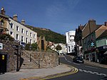
Link Top is a locality of Malvern Link, a major population area of the town of Malvern, Worcestershire, England. It is situated at the western extremity of Malvern Link at its boundary with Great Malvern and North Malvern. It is centred on a sharp left hand bend in the Worcester Road (A449) that forms a complex junction with the North Malvern Road, Hornyold Road, Newtown Road, and Lygon Bank, The main shopping area of Link Top stretches along the Worcester Road and Newtown Road and contains most of the retail outlets and amenities common to a village including pharmacies, dry goods stores, electrical and TV shops, hairdressers, hardware stores, fast-food, a post office, and a number of pubs. The centre of the area is dominated by the Church of the Holy Trinity (Anglican), the parish church of North Malvern, built in 1851 and its large parish hall.

Excerpt from the Wikipedia article Link Top (License: CC BY-SA 3.0, Authors, Images).

Link Top
Worcester Road, Malvern Hills Malvern

Geographical coordinates (GPS) Address Nearby Places
placeShow on map

Wikipedia: Link TopContinue reading on Wikipedia

Geographical coordinates (GPS)

Latitude Longitude
N 52.1206 ° E -2.3301 °
placeShow on map

Address

Worcester Road

Worcester Road
WR14 1EP Malvern Hills, Malvern
England, United Kingdom
mapOpen on Google Maps

Holy Trinity Church Hall geograph.org.uk 884543
Share experience

Nearby Places

Malvern, Worcestershire

Malvern (, locally also: ) is a spa town and civil parish in Worcestershire, England. It lies at the foot of the Malvern Hills, a designated Area of Outstanding Natural Beauty. The centre of Malvern, Great Malvern, is a historic conservation area, which grew dramatically in Victorian times due to the natural mineral water springs in the vicinity, including Malvern Water. At the 2021 census it had a population of 30,462. It includes Great Malvern on the steep eastern flank of the Malvern Hills, as well as the former independent urban district of Malvern Link. Many of the major suburbs and settlements that comprise the town are separated by large tracts of open common land and fields, and together with smaller civil parishes adjoining the town's boundaries and the hills, the built up area is often referred to collectively as The Malverns.Archaeological evidence suggests that Bronze Age people had settled in the area around 1000 BC, although it is not known whether these settlements were permanent or temporary. The town itself was founded in the 11th century when Benedictine monks established a priory at the foot of the highest peak of Malvern Hills.: 17–24  During the 19th century Malvern developed rapidly from a village to a sprawling conurbation owing to its popularity as a hydrotherapy spa based on its spring waters.: 197–198  Immediately following the decline of spa tourism towards the end of the 19th century, the town's focus shifted to education with the establishment of several private boarding schools in former hotels and large villas. A further major expansion was the result of the relocation of the Telecommunications Research Establishment (TRE) to Malvern in 1942. QinetiQ, TRE's successor company, remained the town's largest local employer in 2009.Malvern is the largest place in the parliamentary constituency of West Worcestershire and the district of Malvern Hills, being also the district's administrative seat. It lies adjacent to the Malvern Hills Area of Outstanding Natural Beauty. The civil parish is governed by Malvern Town Council from its offices in Great Malvern.