place

Furuset kulturpark

Oslo geography stubsParks in Oslo
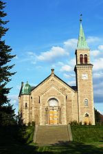
Furuset kulturpark sett mot nord

Furuset kulturpark is a park in the neighborhood of Furuset in Oslo, Norway. It opened in May 2009 at a cost of NOK 5.6 million.The 15.2 acre park is operated by the municipality and is used for recreational purposes, with a pedestrian and bicycle paths and a recreational area. Furuset Church (Furuset Kirke) is in the vicinity. In the park there is a field of flowers and flowering trees and a pond. In the summer months, goats from Nordre Lindeberg 4H-farm are let out to graze in a paddock in the park.

Excerpt from the Wikipedia article Furuset kulturpark (License: CC BY-SA 3.0, Authors, Images).

Furuset kulturpark
Ulsholtveien, Oslo Alna

Geographical coordinates (GPS) Address Nearby Places
placeShow on map

Wikipedia: Furuset kulturparkContinue reading on Wikipedia

Geographical coordinates (GPS)

Latitude Longitude
N 59.942803055556 ° E 10.889468055556 °
placeShow on map

Address

Furuset kirke

Ulsholtveien
1052 Oslo, Alna
Norway
mapOpen on Google Maps

Furuset kulturpark sett mot nord
Share experience

Nearby Places

Grorud Valley
Grorud Valley

The Grorud Valley (Norwegian: Groruddalen) is a valley and urban area or suburb in the northeastern part of Oslo, the capital of Norway. Four of Oslo's boroughs lie within the Grorud Valley; Bjerke to the west, Alna to the south, Grorud to the north, and Stovner to the east. The name Groruddalen has been in use at least since the mid-19th century. The current use of the name Groruddalen was coined in 1960 to describe the area covered by the local newspaper Akers Avis Groruddalen, until then named Akers avis. Before 1960, this area was known as Akersdalen, whilst the name Groruddalen was user for the river valley from lake Alnsjøen along Alna River to Bryn.The population of the Grorud Valley is around 140,000 (approximately a fifth of the population of Oslo). The main population centers are on the valley sides, close to the forest of Lillomarka and Østmarka. The valley basin has fewer houses but a fair amount of industry. Thanks to large scale urbanization throughout the valley in the 1960s and 1970s, it was transformed from agricultural to suburbian landscape. Generally the neighborhoods are well maintained and there are recreational facilities and open spaces in the Grorud Valley.The Grorud Valley is served by several motorways and rail lines running along the valley. In the south of the valley is the European route E6 highway and the subway line Furusetbanen. The central valley is served by Norwegian Route 163 (Østre Aker vei) as well as Hovedbanen rail line. The north side is served by Norwegian Route 4 (Trondheimsveien) and the subway line Grorudbanen.